
Tag "remote sensing"

Earth-i Steps Up to Support the UK Space Industry
Earth-i has taken the opportunity to support the UK Space industry’s main gathering to discuss policy, progress and challenges by becoming a Gold Sponsor of the UK Space Conference 2017 held
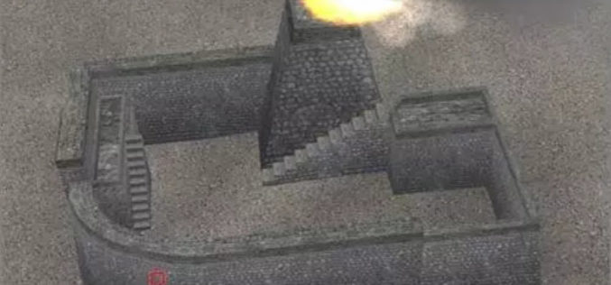
Chinese Scientists Use Remote Sensing Technology to Digitize Great Wall
Researchers from the Chinese Academy of Sciences (CAS) recently used remote-sensing equipment in their efforts to restore a vanished section of the Great Wall in Northwest China’s Xinjiang Uyghur Autonomous
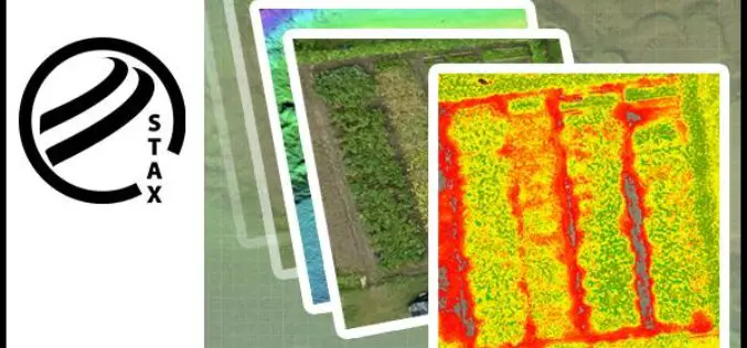
PCI Geomatics Releases STAX for UAV
MARKHAM, Ontario, Canada — March 07, 2017: PCI Geomatics, a world-leading developer of remote sensing and photogrammetric software and systems, announced today that it has released a new UAV image

World View and Ball Aerospace Demonstrate Persistent Remote Sensing from Stratollite Platform
Successful Proof of Concept Test for Commercial Use Tucson, Ariz., Feb. 23, 2017 – World View and Ball Aerospace successfully completed a Stratollite mission earlier this month, demonstrating early capabilities
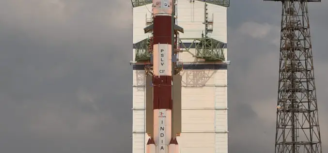
ISRO Successfully Launched Cartosat-2 Series Satellite Along with 103 Co-passenger Satellites
Sriharikota, India – In its thirty-ninth flight (PSLV-C37), ISRO’s Polar Satellite Launch Vehicle successfully launched the 714 kg Cartosat-2 Series Satellite along with 103 co-passenger satellites today morning (February 15,

BRICS Nations to Share Data from Remote Sensing Satellites
IANS – Bengaluru: The five-nation group of BRICS will share spatial data on natural resources from their remote-sensing satellites for utilizing space assets optimally, said a top Indian space official on

Training Course on GIS and Remote Sensing for Agricultural Resource Management
Training course on GIS and Remote Sensing for agricultural resource management April 17, 2017 – April 21, 2017 For optimum utilization of available agricultural land resources on a sustainable basis,

PCI Geomatics Joins UK’s Geologic Remote Sensing Group (GRSG)
MARKHAM, Ontario, Canada, February 08, 2017 — PCI Geomatics, a world leading developer of remote sensing and photogrammetric software and systems, announced today it has joined the UK’s Geologic Remote
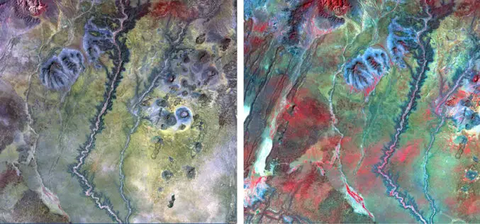
NAU Scientist Uses Remote Sensing to Detect Groundwater in Drought-stricken East Africa
Drought is a condition when a region notes a deficiency in its water supply whether surface or underground water. A drought can last for months or years, or may be declared
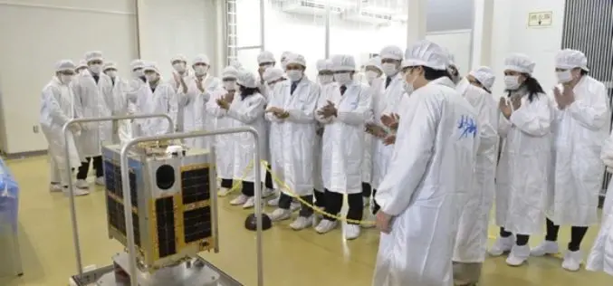
Philippines Joins Space Race with the Launch of Diwata-1 Microsatellite
According to recent news reported by IPS – The Philippines, has joined the colossal world of space technology, building its second microsatellite that it plans to launch late this year or
