
Tag "remote sensing"
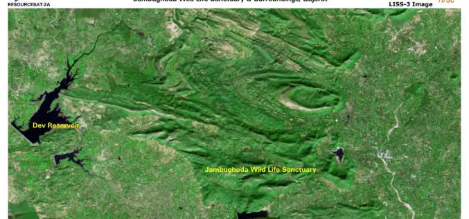
ISRO Releases First Day Images of RESOURCESAT-2A
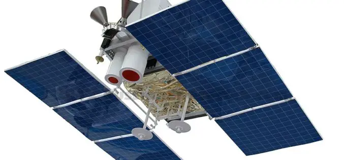
RESOURCESAT-2A is a Remote Sensing satellite intended for resource monitoring. RESOURCESAT-2A was launched successfully by PSLV-C36 / on December 07, 2016 at 10:25 hrs (IST) from SDSC SHAR, Sriharikota. RESOURCESAT-2A is

Geological Survey of India Finds Huge Gold Deposits
Karnataka – According to recent news by the Deccan Herland, the Geological Survey of India (GSI) has found large gold deposits spread over 600 sq km between Shikaripur in Shivamogga

Iran Urges Russia to Start Building Remote Sensing Satellite
The Iranian minister for Communication and Information Technology, Mahmoud Vaezi, urged Russia to start work on constructing the remote sensing satellite both countries agreed upon earlier this year. Speaking in

NASA’s CYGNSS Launch Takes Surrey Satellite’s Space GNSS Receiver into Orbit
ENGLEWOOD, COLO. — Surrey Satellite Technology’s Space GNSS Receiver Remote Sensing Instrument (SGR-ReSI) is the primary payload onboard NASA’s CYGNSS constellation, launched today, December 15. The Cyclone Global Navigation Satellite System
ISRO and USGS Signed MoU for Cooperation in Exchange on Remote Sensing Data
New Delhi, (PTI) – A Memorandum of Understanding (MoU) has been signed between Indian Space Research Organisation (ISRO) and United States Geological Survey (USGS) for cooperation in the exchange and
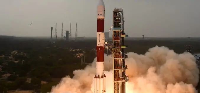
ISRO Successfully Launches RESOURCESAT-2A Remote Sensing Satellite
In its thirty-eighth flight (PSLV-C36), ISRO’s Polar Satellite Launch Vehicle successfully launched the 1235 kg RESOURCESAT-2A Satellite December 07, 2016 morning from Satish Dhawan Space Centre SHAR, Sriharikota. This is

Mitsubishi Corporation and Hitachi Form Remote Sensing Joint Venture
Mitsubishi Corporation (MC) and Hitachi, Ltd (Hitachi) today announce the formation of a new joint venture that will provide comprehensive remote sensing services for industrial use. The new venture, SkymatiX,

China Made Venezuela and Pakistan Remote Sensing Satellite Launch in 2018
According to recent news by the Business Recorder, China Great Wall Industry Corp, the nation’s only authorized firm for international space collaboration, will launch Venezuela’s second remote sensing satellite next
Russian Satellite “Canopus” Will be Part of Joint BRICS Nations
According to recent news Russia & India Report, the Russian satellite ‘Canopus’ will be part of the BRICS countries (Brazil, Russia, India, China and South Africa) joint grouping of remote sensing

International Conference on Urban Geoinformatics (ICUG) – 2017, Teri University, New Delhi
The rapidly-evolving field of urban Geoinformatics can play a pivotal role in the ‘smart cities’ of the future. TERI University is organising the inaugural edition of the International Conference on
