
Tag "SuperGeo"

SuperSurv M3 Flash Sale for Cost-Effective Field Data Collection
Supergeo Technologies, a leading global provider of GIS software and solutions, announces that SuperSurv M3, the professional mobile GIS app for Android and iOS powered devices, is now on 50%
Supergeo Launches Mobile Cadastral GIS 3.2
Supergeo announced that Mobile Cadastral GIS 3.2 is officially launched for field surveyors to timely query and measure cadastral data on site with their Android devices. Mobile Cadastral GIS 3.2

Better Infectious Rickettsioses Prevention in Taiwan with SuperGIS Desktop
The professional GIS desktop software, SuperGIS Desktop, supports Dr. Chung-Hsu Lai, I-Shou University, Kaohsiung, Taiwan, in the research of human spotted fever group rickettsioses, SFGR, to provide geographical relations of
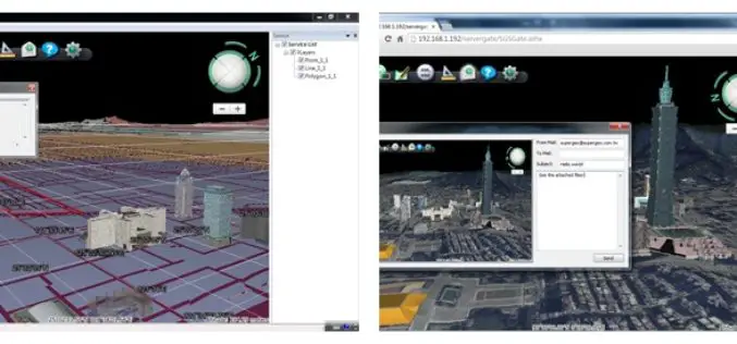
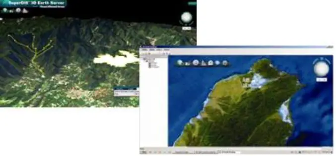
Superior 3D Map Viewing with SuperGIS 3D Earth Server Front-end Applications
To provide users a superior 3D map experience, Supergeo releases whole new front-end applications, the desktop client application, SuperGIS 3D Earth, and the browser plug-in, SuperGIS 3D Earth Plug-in, for
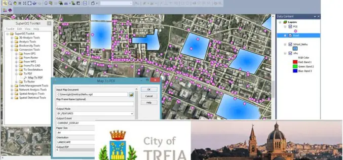
Italian Local Government Manages Urban Planning through SuperGIS Desktop
Supergeo Technologies, a leading global provider of GIS software and solutions, pleasantly announces that Urban Planning and Unique Construction Branch, Municipality of Treia, Italy selects SuperGIS Desktop to manage and
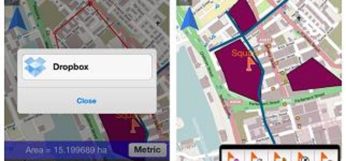
SuperSurv 3.2 for iOS Supports Cloud Storage
SuperSurv 3.2 for iOS, the newest mobile GIS app released by Supergeo, enables users to import data through cloud hard drive and supports more US local coordinate systems, providing iOS
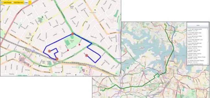
SuperGIS Server Silverlight API Samples Supports Powerful Network Analyses
Supergeo Technologies provides rich API samples for GIS developers to effortlessly customize web map services through SuperGIS Server 3.1a. Among them, SuperGIS Server Silverlight API newly includes the samples indicating
SuperGIS 3D Earth Server 3.2 to Enhance 3D Map Display Performance
Supergeo Technologies is going to release front end applications for enhanced 3D map display performance for SuperGIS 3D Earth Server 3.2 users. The desktop client application, SuperGIS 3D Earth, is

Jakarta Fire Department Utilizes SuperPad to Secure Citizens and Properties
Supergeo Technologies, a leading global provider of GIS software and solutions, assists the Department of Building and Fire, Bekasi, Jakarta in enhancing citizens’ life through SuperPad, the professional GIS data

Streamlining Field Survey & Mobile Mapping by SuperSurv
Streamlining Field Survey & Mobile Mapping by SuperSurv Join on Wednesday, June 4th 11:00 AM – 12:00 PM (EDT, New York Time) About Webinar: How could smart devices assist in
