
Tag "Synthetic Aperture Radar"
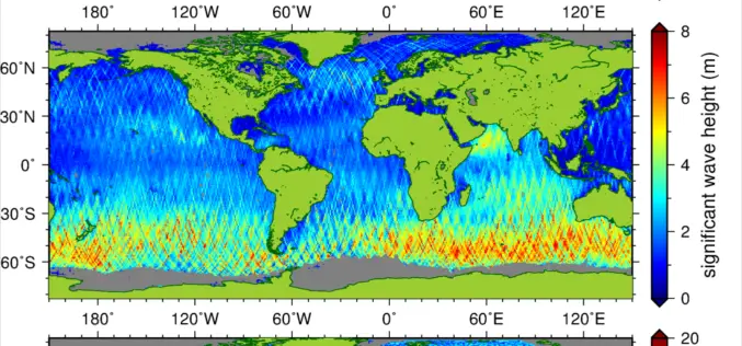
New Suite of Products Available For SRAL Instrument on the Copernicus Sentinel-3a Satellite
The Synthetic Aperture Radar Altimeter (SRAL) instrument on board Sentinel-3A delivers accurate measurements of sea surface height, significant wave height and surface wind speeds over the world’s oceans for Copernicus
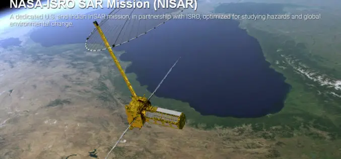
Opportunity for Young Scientist to be a Part of NASA-ISRO Synthetic Aperture Radar (NISAR) Data Program
AHMEDABAD: Here is a chance for young scientific researchers and data crunchers to be part of Isro’s ambitious NASA-ISRO Synthetic Aperture Radar (NISAR) satellite data analysis program. This will be
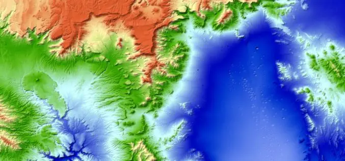
New 3D World Map – TanDEM-X Global Elevation Model Completed
The new three-dimensional map of Earth has been completed. Mountain peaks and valley floors across the globe can now be seen with an accuracy of just one metre. The global
NISAR – NASA-ISRO Synthetic Aperture Radar Mission
According to recent by The Indian Express, the Indian Space Research Organisation (ISRO) and NASA’s Jet Propulsion Laboratory are jointly working on the development of a Dual Frequency (L&S band)
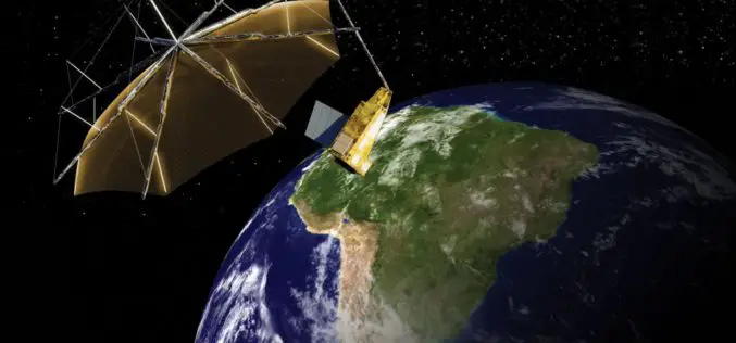
Airbus Defence and Space to Build Biomass – the European Space Agency’s Forest Mission
1st P-band radar in space will measure the amount of biomass and carbon locked in the world’s forests and how this changes over time Biomass satellite will provide support to

PCI Geomatics to Hold User Group Meeting in Ottawa, Canada
PCI Geomatics, a world leading developer of remote sensing and photogrammetric software and systems, will be holding a User Group Meeting in Ottawa, Canada on February 4th, 2016. The free
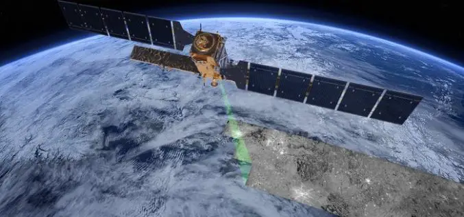
The “Radar Vision” Goes On – Two More Sentinel-1 Satellites
– Airbus Defence and Space signs €143M contract with Thales Alenia Space – New Sentinel instruments ensure services for Copernicus beyond 2029 Airbus Defence and Space, the world’s second-largest space

SAR Processing with Geomatica Training Course
Master Geomatica from the comfort of your own desk! 2015 Training Sessions on now! Course: SAR Processing in Geomatica Throughout the year our top instructors deliver expert training in a convenient
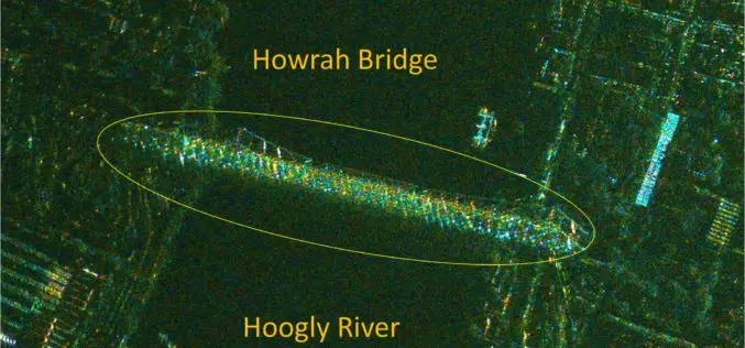
India’s RISAT-1 High Resolution SpotLight (HRS) Polarimetric Image
Indian Space Research Organization’s (ISRO) Radar Satellite-1 (RISAT-1) is a state of the art Microwave Remote Sensing Satellite carrying a Synthetic Aperture Radar (SAR) Payload operating in C-band (5.35 GHz), which

Webinar Series: DEM Extraction from SAR Imagery
Get More From Imagery Webinar Series: DEM Extraction from SAR Imagery Nov. 19, 2015 at 4am EDT (9am GMT) | Nov. 19, 2015 at 2pm EDT (7pm GMT) PCI Geomatics is the
