
Tag "TerraSAR-X"
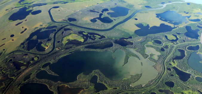
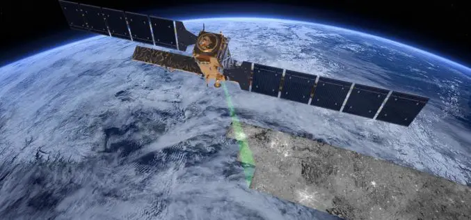
Thawing Arctic in Radar View – Permafrost Monitoring with Latest Radar Technology in German-Canadian Cooperation
September 17, 2018 – DLR German Aerospace Center, Germany – Scientists from the German Aerospace Center (Deutsches Zentrum fuer Luft- und Raumfahrt; DLR) Microwaves and Radar Institute are developing special
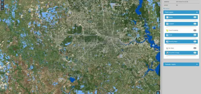
DLR Provides Satellite Data for Hurricane Harvey
DLR provides satellite data for Hurricane Harvey Radar images from TerraSAR-X German Aerospace Center (DLR) provides real-time recordings and archive data of the German radar satellite TerraSAR-X. DLR supports hurricane
Excellence in space – 10 years of TerraSAR-X
The TerraSAR-X satellite has been in service for twice the planned time. The data has been providing valuable insights regarding changes to the Earth’s surface for the past 10 years.
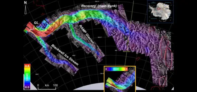
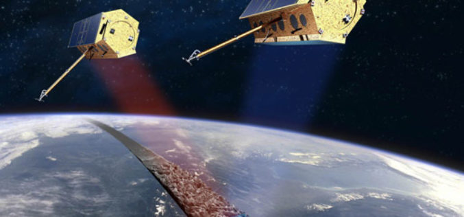
Benefits and Potential of RADAR Satellites: TerraSAR-X and TanDEM-X
The German satellite duo TerraSAR-X and TanDEM-X have consistently delivered one-of-a-kind Earth observation data since 2007 and 2010, hence shaping the international research landscape. TanDEM-X is being implemented on behalf of
MARSAT – Assisting the Maritime World from Space
New satellite-based services for increased safety and efficiency in shipping A new corporate network will ensure increased safety and lower costs in the field of maritime traffic in future. Five

TerraSAR-X and RADARSAT-2 to Improve Monitoring Over North Canadian Region
– The German Aerospace Center (DLR) has awarded Airbus Defence and Space with two research projects to enhance Emergency Preparedness and Safety of Operations in collaboration with Canadian partners –
Free Provision of TerraSAR-X and TanDEM-X Data for Government Studies and Professional Training in Canada
Airbus Defence and Space has signed an agreement with the Canada Centre for Mapping and Earth Observation (CCMEO) providing Canadian governmental and institutional data users free access to TerraSAR-X and

PCI Geomatics Guest Lecturing at Canadian University on Synthetic Aperture Radar (SAR)
MARKHAM, Ontario, Canada—March 10, 2015: PCI Geomatics, a world leading developer of remote sensing and photogrammetric software and systems, announced today that Gabriel Gosselin, PhD., Radar Remote Sensing Scientist for

InSAR/Seismological Investigation Studentship Programme
In 2012, the Natural Environment Research Council announced that it wished to concentrate research student training in larger cohorts, and invited bids for Doctoral Training Partnerships to provide this training.
Its Free! – CSAR 2014 SAR Workshop
USGIF Commercial SAR Workshop Series AFRICOM/EUCOM The Huntingdon Marriott Hotel, Molesworth, 17-18 February 2014 Pullman Stuttgart Fontana Hotel, Stuttgart, Germany, 20-21 February 2014. USGIF and the Commercial Synthetic Aperture Radar
