
Tag "UAS"

Trimble Partners with Industry Leading Multirotor Unmanned Aircraft System Manufacturer
New Geospatial and Agriculture Workflows and Deliverables through Additional Aerial Imaging Solutions ATLANTA, May 5, 2015—Trimble (NASDAQ: TRMB) announced today that it is partnering with leading unmanned aircraft system (UAS)

The 5most viewed UAVs for Mapping and 3D Modelling on Geo-matching.com
The Geo-matching.com website features a selection of the most important geomatics equipment, including UAS for Mapping and 3D Modelling. At www.geo-matching.com you can compare product specifications and read users’ reviews
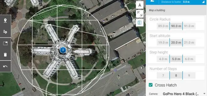
Go from UAS Imagery to Valuable 3D Information with the New Summit UAS OneButton Bundle
Anchorage, Alaska, USA. April 21, 2015 – DAT/EM Systems International and Icaros, Inc. announced the release of a collaborative software solution that processes and analyzes Unmanned Aerial Systems (UAS) data.
3D Robotics (3DR) Announces DroneKit SDK and API for Developing Drone Apps
3D Robotics (3DR), North America’s largest consumer drone manufacturer, has released a new open software product called DroneKit – Software Development Kit (SDK) and Application Programming Interface (API) for drone app development. DroneKit allows developers

Smartone C from Smartplanes Reviewed By the Geo-Matching Community
The Geo-matching.com website features a selection of the most important geomatics equipment, including UAS for Mapping and 3D Modelling. At www.geo-matching.com, you can compare product specifications and read users’ reviews

Webinar: AirGon Presents small UAS Metric Mapping Workflows
AirGon Presents small UAS Metric Mapping Workflows Wed, Mar 4, 2015 2:00 PM – 3:00 PM CST In this webinar we will be taking a look at a complete workflow

DOT and FAA Propose New Rules for Small Unmanned Aircraft Systems
Regulations Will Facilitate Integration of Small UAS into U.S. Aviation System Washington – The Department of Transportation’s Federal Aviation Administration today proposed a framework of regulations that would allow routine
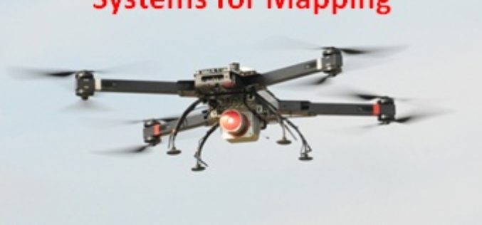
Webinar: Unmanned Aerial Systems for Mapping
Webinar: Unmanned Aerial Systems for Mapping January 15, 2015: 10:00 am to 11:00 am Unmanned Aerial Systems (UAS) or drones have garnered a lot of headlines recently. The term “drone”

Unmanned Aerial Vehicles (UAV)
According to the UVS International definition, a UAV is a generic aircraft design to operate with no human pilot onboard. Unmanned Aerial Vehicles (UAV) has recently become commercially available at
