
Tag "UAV"

Mapping Australia’s Dinosaurs Landscape Using LiDAR and Drones
According to recent news by BBC, Scientists are trying to reconstruct ancient Australian landscapes once roamed by some of the biggest dinosaurs. The 130-million-year-old footprints are virtually the only record of
UAV-g 2015 International Conference: Thrilling Success
UAV-g 2015 International Conference, York University, Toronto, Aug 30-Sep 2, 2015 The UAV-g 2015 International Conference of Unmanned Aerial Vehicles in Geomatics with the theme Small Unmanned Aerial Systems (sUAS):
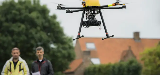
Trimble Takes Flight with New Multirotor Unmanned Aircraft System
Latest Addition to UAS Portfolio Makes Working in Tight Spaces Easy Trimble (NASDAQ: TRMB) announced today the ZX5 Multirotor Unmanned Aircraft System (UAS), a new aerial imaging and workflow solution
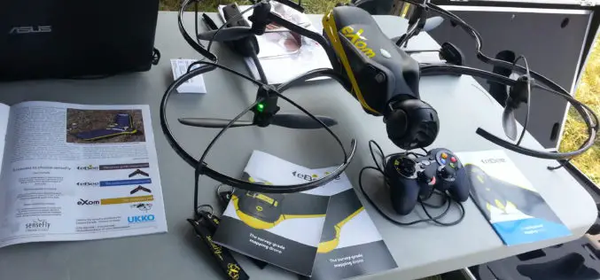
The 5 most viewed UAVs for Mapping and 3D Modelling on Geo-matching.com
The Geo-matching.com website features a selection of the most important geomatics equipment, including UAS for Mapping and 3D Modelling. At www.geo-matching.com you find product specifications, videos, brochures and more. Geo-matching.com
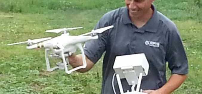
Drones to Access Crop Condition and Farming Possibilities
Drones in agriculture have transformed the way of capturing remotely sensed data and have proven their capability in many other domains. With the capability of acquiring high resolution data (spatial, spectral,

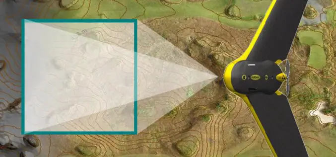
senseFly eBee Becomes Canada’s First Compliant Fixed-Wing Drone
Mapping UAV’s new designation will help Canadian operators to boost their businesses. The senseFly eBee has become the first fixed-wing system to be designated a ‘compliant small UAV’ by Transport Canada—a

Strong Increase Enquiries on UAVs for Mapping and 3D Modelling in 2015
Geo-matching.com is the first independent product comparison website for geomatic, hydrographic and related industries field. Especially the enquiries and traffic on UAS for Mapping and 3D Modelling products have shown

Commercial UAV Expo Announces 2015 Conference Program
Unmanned Aerial Systems (UAS) Experts to Speak at SPAR Point Group’s Inaugural UAV Event in Las Vegas October 5-7 Portland, Maine, USA – June 23, 2015 – The organizers of Commercial
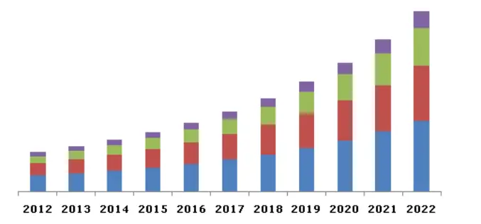
Global LiDAR Market By Product, By Application, By Component Expected To Reach USD 944.3 Million By 2022
The global LiDAR market is expected to reach USD 944.3 million by 2022, according to a new study by Grand View Research, Inc. Escalating demand for 3D imagery in line

RIEGL adds VMZ-2000 to Geo-matching.com
RIEGL has added the VMZ-2000 to the Mobile Mappers product category on Geo-matching.com. Visit Geo-matching.com for a complete product overview and compare solutions. Geo-matching.com is the first product comparison website
