
Tag "UAV"

IIT-Roorkee Professor Develops New Technology for Aerial Survey
According to recent news by the Hindustan Times, Professor Kamal Jain at the civil engineering department of the IIT used a drone for taking videos with an interactive web map to demonstrate
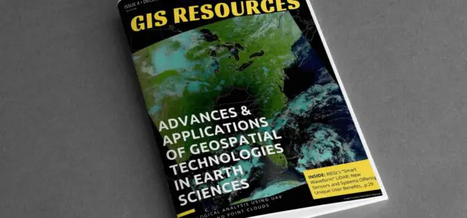
4th Edition of GIS Resources Magazine: Advances & Applications of Geospatial Technologies in Earth Sciences
GIS Resources Magazine (4th Edition): Advances & Applications of Geospatial Technologies in Earth Sciences GIS Resources, a leading global platform for latest and high-quality information source for the geospatial industry, announcing
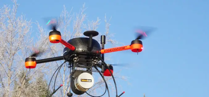
YellowScan and Geotrim Sign a Distribution Agreement for Finland
Montpellier, 15 December 2017 – YellowScan and Geotrim have concluded a distribution agreement for Finland. Headquartered in Vantaa, Geotrim is the Finnish Distributor of Trimble Geomatics solutions with long time experience

Cyient to Host Hackadrone 2018–India’s First UAV Hackathon
Participation open to developers, start-ups, college students, and independent software programmers from across the country Hyderabad, India, Dec. 6, 2017/PRNewswire/ — Cyient, a global provider of engineering, manufacturing, geospatial, network, and
NovAtel’s GPS Anti-Jam Technology Selected for the United Kingdom’s Type 26 Frigate
Calgary, Canada, November 29, 2017 – NovAtel® announced today that its GPS Anti-Jam Technology (GAJT®) has been selected for the United Kingdom’s Type 26 Frigates to meet a requirement as part
Create Photogrammetric Point Cloud Using Global Mapper Pixels-to-Points Tool
Global Mapper LiDAR Module v.19 Now Available with Pixels-to-Points™ Tool for Photogrammetric Point Cloud Creation November 29, 2017 – Blue Marble Geographics is pleased to announce the release of version 19 of the

Presagis Introduces New Automated Virtual Environment Production Solution
November 27 2017 – Montreal, Canada – Presagis™, a recognized leader in modeling and simulation software, today introduced VELOCITY, a next-generation software solution that automates the production of large synthetic training
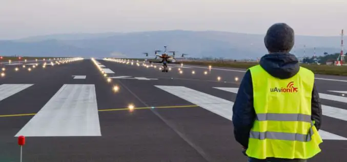
uAvionix, Leader in Drone Communications, Navigation, and Surveillance Systems, Secures Series B Funding from Airbus Ventures, Playground Global, and Redpoint Ventures
The investment reinforces uAvionix’s mission to enable airspace awareness through high integrity aviation solutions for both manned and unmanned aircraft. Bigfork, MT, November 27, 2017 – uAvionix Corporation – a leading
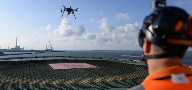
Centrik Helps Texo DSI Evidence UAV Excellence and Boost Operational Efficiency
November 15, 2017 (Centrik)- Texo Drone Survey and Inspection Limited (Texo DSI), the owner operator of the world’s most advanced and dynamic fleet of unmanned aerial vehicles, has adopted Centrik
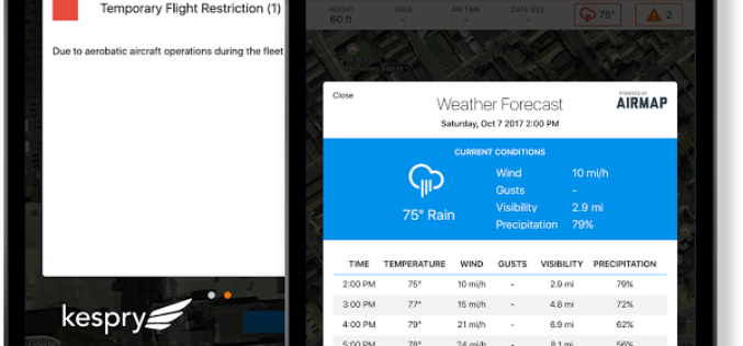
AirMap and Kespry Partner for Safe, Compliant Drone Flights
New integration brings AirMap airspace intelligence to the Kespry platform for automated drone operations Santa Monica, CA (November 9, 2017) – AirMap and Kespry has announced a partnership that brings AirMap’s best-in-class airspace intelligence, including airspace
