
Tag "Webinar"
CartoDB Webinar: Get started using CartoDB’s Mobile SDK
Webinar: Get started using CartoDB’s Mobile SDK Wednesday, June 29 @1PM EDT (10AM PST / 7PM CEST) Join this 45-minute session to learn how CartoDB’s Mobile SDK expands your data

PCI Geomatics Webinar: Digital Elevation Models and Operational Mining Applications
Digital Elevation Models and Operational Mining Applications Case Study with NPA Satellite Mapping JUNE 29, 2016 | 10AM ET / 2PM GMT PCI Geomatics and CGG’s NPA Satellite Mapping team will
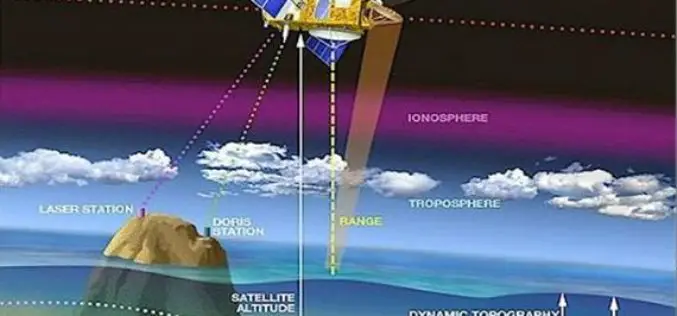
Webinar: NASA Space Geodesy Data for Precise Orbit Determination of Altimeter Satellites
Webinar: NASA Space Geodesy Data for Precise Orbit Determination of Altimeter Satellites Wednesday, June 29, 2016 at 2:00PM EDT (UTC/GMT-4) Over the last 25 years, ocean radar altimeter satellites have

Esri India Webinar: What’s new in ArcGIS 10.4 Desktop?
Esri India Webinar: What’s new in ArcGIS 10.4 Desktop? 2nd June 2016, 11:00 AM IST onwards ArcGIS 10.4, the latest release, includes exciting new capabilities for visualizing and analyzing data.
CartoDB Webinar: Deep Insights – Transform Your Data Into Actionable Insights
Deep Insights – Transform Your Data Into Actionable Insights Recorded | Duration 45 Minutes Did you miss our last Deep Insights webinar? CartoDB’s Sales Director, Jaime de Mora, gave a

SuperGIS Webinar: Planning and Managing Tourism in a Spatial Way
Planning and Managing Tourism in a Spatial Way Wednesday, 1st June | 09:00 AM (GMT+2) Your local time “Adventure is worthwhile in itself.” Indeed, tourism is one of the fastest growing industries
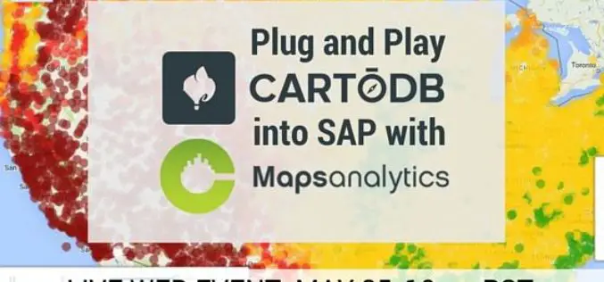
Webinar: Plug and Play CartoDB into SAP with CMaps Analytics
CMaps Analytics is thrilled to team up with CartoDB for an upcoming web event showcasing our latest integrated solution for embedding Location Intelligence into your SAP investments. Thursday, May 25 at 1PM CMaps Analytics is a

NASA ARSET Training: Using NASA Remote Sensing for Disaster Management
NASA ARSET Training: Using NASA Remote Sensing for Disaster Management 06/09/2016 to 06/30/2016 Times: 11:00 a.m.-12:00 p.m. and 6:00-7:00 p.m. EDT (UTC-4) NASA remote sensing and modeling resources are useful for
Fundamentals of Satellite Remote Sensing for Health Monitoring
NASA ARSET Training: Fundamentals of Satellite Remote Sensing for Health Monitoring 02 Jun. 2016 to 30 Jun. Times: 10:00-11:30 a.m. and 3:00-4:30 p.m. EDT (UTC-4) Predicting and monitoring disease outbreaks and environmental

Webinar:- Innovations in Geocoding 2016: Weave location into the very fabric of your data to gain new efficiencies and insight
Event Information: Innovations in Geocoding 2016: Weave location into the very fabric of your data to gain new efficiencies and insight Tuesday, April 26, 2016 2:00 pm Eastern Daylight Time
