Georeferencer.ai is here to make georeferencing maps faster, easier, and more accessible than ever. With just a few clicks, anyone can align maps to real-world coordinates without special software or technical expertise.
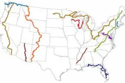
Georeferencing might sound complicated, but the idea is simple: it tells a map where it actually sits on Earth. Once a map is georeferenced, it can be overlaid on modern imagery, allowing users to see exactly where everything lines up. This opens up possibilities for exploring historical maps, tracking changes over time, and understanding geography with precision.
A Simpler Way to Georeference Maps
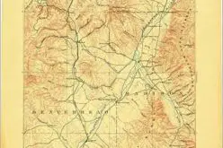
Traditionally, georeferencing has been tedious and technical. Georeferencer.ai changes that by letting users complete the process entirely in their browser. Simply upload a map, match four or more points, and the tool automatically generates a precise georeferenced overlay ready for download.
Also Read – What is Georeferencing?
Use Your Maps Anywhere
Once georeferenced, maps can be used in any software, project, or workflow. Users can also upload them to Soar, a platform offering free, unlimited map storage and an easy way to share maps with a global community of map enthusiasts. Georeferencer.ai integrates seamlessly with Soar Atlas accounts, allowing smooth transitions between platforms.
Built for Everyone
Millions of maps online remain as flat images with no real-world context. Georeferencer.ai transforms these maps into meaningful, usable resources. By removing the technical barriers, the platform empowers communities, organizations, and individuals to explore, restore, and share maps like never before.
Georeferencer.ai is now live and ready to use. Try it today and discover how simple it can be to give your maps real-world context.
Website: https://georeferencer.ai