
Archive
Oklahoma Forestry Services Using Wildfire App to Save Lives
Oklahoma Forestry Services is using wildfire app “Collector” in firefighting. Collector is a cutting-edge app to fight fire and save lives. Oklahoma is the first state in the United States of
NASA: California Tuolumne Snowpack 40 Percent of Worst Year
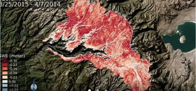
New NASA data find the snowpack in the Tuolumne River Basin in California’s Sierra Nevada — a major source of water for millions of Californians — currently contains just 40
Urban Surface Temperature Time Series Estimation at the Local Scale by Spatial-Spectral Unmixing of Satellite Observations
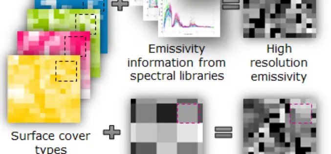
Urban Surface Temperature Time Series Estimation at the Local Scale by Spatial-Spectral Unmixing of Satellite Observations – Zina Mitraka, Nektarios Chrysoulakis, Georgia Doxani, Fabio Del Frate and Michael Berger Abstract: The study of urban

Introduction to GIS for Agriculture: Rangeland Focus Workshop
Introduction to GIS for Agriculture: Rangeland Focus Workshop Wednesday, April 15th, 2015, from 8:00am to 1:00pm Informatics and GIS Program (IGIS) by University of California aims to support research technology

Spatial Mapping Reveals Importance of Hauraki Gulf Waters
The most extensive spatial mapping of the Hauraki Gulf waters has identified a new area of importance for nationally endangered bottlenose dolphins, as well as demonstrating how these waters are
Optech Presenting the Latest Mapping Solutions for Geosciences at EGU 2015
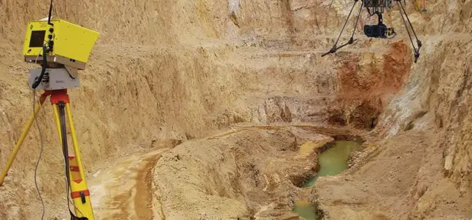
April 8, 2015 — Optech is pleased to announce that it will attend the 2015 European Geosciences Union (EGU) General Assembly in Vienna, Austria on April 12-17 to discuss the

PR: Children Map the World Using Their Artistry
New Esri Press Book Features Winners of Map Drawing Competition Redlands, California—Young people use their artwork to bring geography and their perspectives on the world to life in the new

NASA ARSET Course on Introduction to Remote Sensing for Conservation Management
The goal of the NASA Applied Remote Sensing Training (ARSET) is to increase the utility of NASA earth science and model data for policy makers, regulatory agencies, and other applied

New National Geospatial Program Director Announced
The U.S. Geological Survey is pleased to announce the selection of Michael Tischler to the position of the Director, National Geospatial Program (NGP), starting Monday, April 6th. Mike brings a

Call for Papers – Geospatial Applications of Big Data Analytics
Recent developments in information technology commonly referred to as ‘Big Data’ along with the related fields of data science and analytics will need to be brought to bear in order
