
Archive

Leica Geosystems DMC III Webinar
25,000 Pixels Across the Sky: A Q&A about CMOS and the New Leica DMC III Airborne Camera Wednesday, September 2, 2015, 8 – 9 p.m. CEST Based on a brand-new

Registers of Scotland Urged Landowners to Register for Digital Mapping Process
Registers of Scotland (RoS) is a national agency and is the non-ministerial department of the Scottish Government responsible for compiling and maintaining records relating to property. Registers of Scotland is
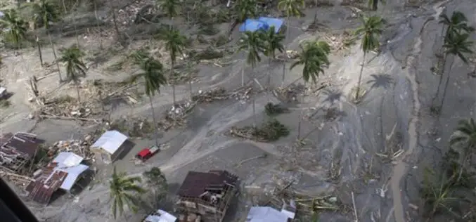
176 Flood Forecasting Stations Established Across India
As many as 176 flood forecasting stations have been set up across the country where predictions are made during every monsoon whenever the water level exceeds limits, Water Resources Minister
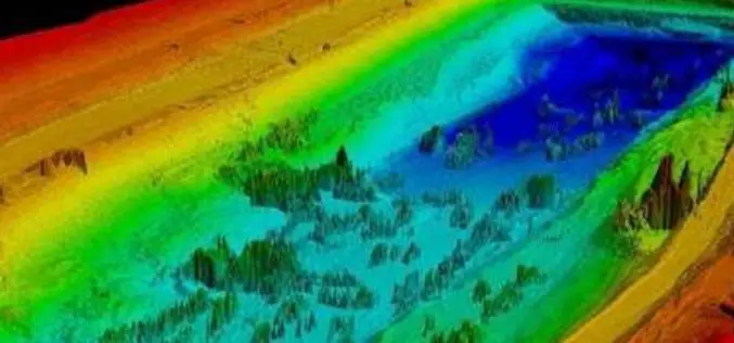
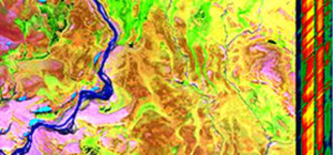
Telangana Government to Take Up LiDAR Survey of Barrages and Canals
As reported in The New Indian Express, the Telangana Government is all set to start the LiDAR survey of the altered Pranahita – Chevella project from August 18. The state government

ISRO Teams Up With Urban Development Ministry, To Map 4,041 Towns
The Indian Space Research Organisation (ISRO) has tied up with the Union Urban Development Ministry for mapping over 500 towns and cities, to make a base plan for better planning
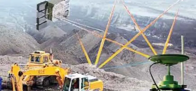
Central Government Insist For DGPS Survey before the Lease of Mines
As reported in Business Standard, the Union Mines Ministry, Government of India has instated on Differential Global Positioning System (DGPS) survey of Kutrumali and Sijimali bauxite deposits before grant of mining lease to
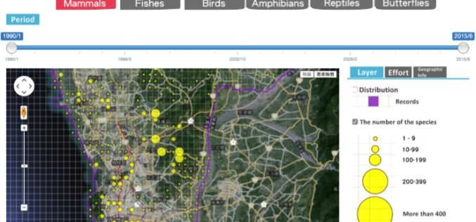
Conserve Biodiversity with GIS – Kaohsiung City Biodiversity Database
As environment becomes the top issue in every country, governments and scientists are eager to find the balance between development and environment protection. GIS as the key solution, offers various
Geo-matching.com Adds Thermal, Multi- and Hyperspectral Imaging
Geo-matching.com has recently added thermal, multi- and hyperspectral imaging to its broad spectrum of product categories. Teledyne Optech is the first supplier in this category with the CS-MS 1920. In addition
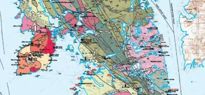
Geologic Map of Baranof Island, Southeastern Alaska Now Online
Alaska — In the 20th century, Baranof Island in Southeastern Alaska has drawn attention for its gold, chrome and nickel deposits, timber industry, potential activity of the dormant Mount Edgecumbe
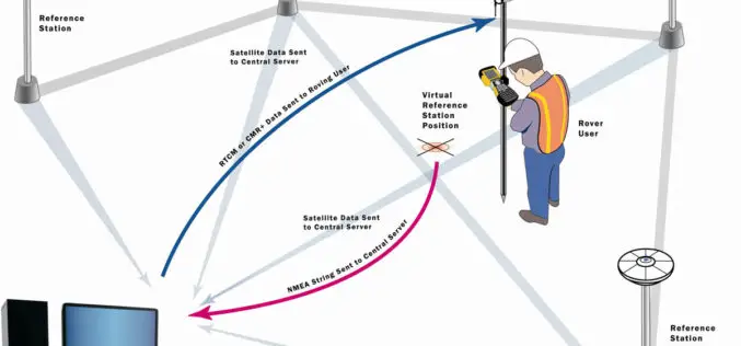
Trimble Launches VRS Now Service in New Mexico
Accurate and Reliable Centimeter-Level GNSS Performance for Geospatial Professionals SUNNYVALE, Calif., Aug. 10, 2015—Trimble (NASDAQ: TRMB) announced today the launch of Trimble® VRS Now™ correction service in New Mexico. The
