
Archive

Belarus and Russia Partners to Define Specifications for a New Belarusian Remote Sensing Satellite
According to recent new by Sputnik, Belarus and Russia has joined their hands to announce technical specifications for a new Belarusian remote sensing satellite. President of the Belarusian Academy of Sciences Vladimir
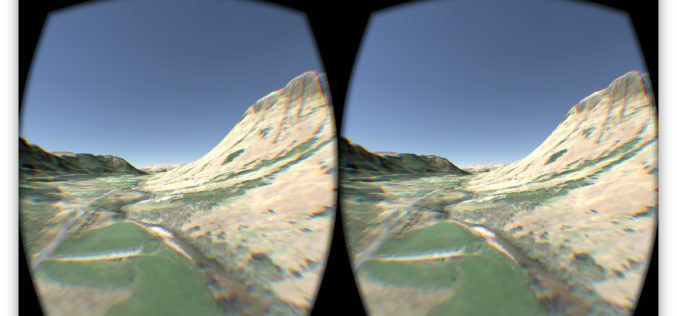
OS Data Gives Reality to a Virtual World
OS follows up its Minecraft map success to make a virtual Ben Nevis for Oculus and cardboard. The spectacular setting of Ben Nevis provides the backdrop for an Oculus Rift

NASA Webinar – Geospatial Data Abstraction Library (GDAL) Enhancements for GIS
Geospatial Data Abstraction Library (GDAL) Enhancements for GIS Thursday, October 29, 2015 at 2pm ET Enable your Earth Observing data products to work in applications built on GDAL, such as

China’s First High-Resolution Satellite Maps Large Part of World
BEIJING: The Ziyuan III, China’s first high-resolution stereo mapping satellite for civilian use, has sent back visual data covering 69.45 million square kilometres of the globe since it was launched in

Innovative Tools for Building Mapping Apps Take Center Stage at Esri DevSummit in Berlin
Highlights Include App Builders and Modernized APIs and SDKs Redlands, California—Developers from around the world will find the latest technology for building geoenabled apps on the ArcGIS platform at the

RIEGL is Attending and Sponsoring Conferences Worldwide!
This week, RIEGL is attending and sponsoring trade shows and conferences worldwide in China, Hong Kong, the Philippines, the United Kingdom, Germany, and the United Arab Emirates! ACRS 2015– The
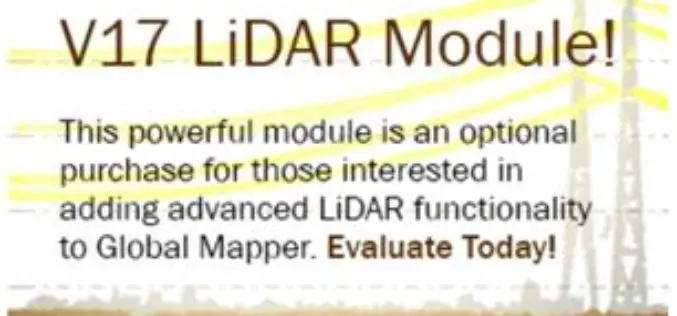
Updated Global Mapper LiDAR Module with Power Line Classification and Extraction
Blue Marble Geographics is pleased to announce the release of Global Mapper LiDAR module version 17.0. Released in conjunction with Version 17.0 of Global Mapper, the latest edition of the module includes

Join Webinar: A Better World with Open Data – GIS Application
A Better World with Open Data – GIS Application Thursday, Oct 29, 2015 1:30 PM – 2:30 PM IST (Show in My Time Zone) Open data is, in fact, not
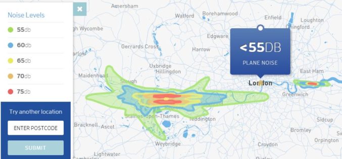
Map Aircraft Noise Pollution Where You Live
Club Med has launched a tool to map noise pollution information from Department for the Environment, Food & Rural Affairs (Defra), UK to map the decibel level from aircrafts. The

PrecisionHawk Joins the U.S. Department of Transportation and FAA in the Creation of a Safety Task Force for UAS
The task force will collaborate on the development of a streamlined registration process for Unmanned Aircraft Systems (UAS) PrecisionHawk has announced its contribution to a safety task force created by
