
Archive

EU-Funded Project Enhanced Space Cooperation Between EU and Ukraine
An EU-funded Twinning Project in space cooperation with Ukraine has succeeded in harmonizing Ukrainian legislation to EU standards and supporting Ukraine’s involvement in EU Space Programmes, particularly in Satellite Navigation
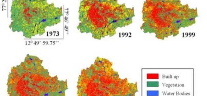
Study Reveal 125% Increase in Bengaluru Urban Growth
In a study by a group of scientists at Indian Institute of Science (IISc) has actually put a number changing land use and land cover in Bengaluru. Between 2000 and
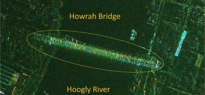
India’s RISAT-1 High Resolution SpotLight (HRS) Polarimetric Image
Indian Space Research Organization’s (ISRO) Radar Satellite-1 (RISAT-1) is a state of the art Microwave Remote Sensing Satellite carrying a Synthetic Aperture Radar (SAR) Payload operating in C-band (5.35 GHz), which
Hexagon Geospatial Officially Launches M.App Chest Cloud App
New Cloud-Based App for Managing and Sharing Geospatial Content Available Hexagon Geospatial is pleased to announce the official launch of M.App Chest, a new cloud-based application associated with the Hexagon Smart M.App® experience,
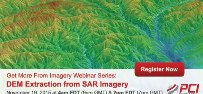
Webinar Series: DEM Extraction from SAR Imagery
Get More From Imagery Webinar Series: DEM Extraction from SAR Imagery Nov. 19, 2015 at 4am EDT (9am GMT) | Nov. 19, 2015 at 2pm EDT (7pm GMT) PCI Geomatics is the
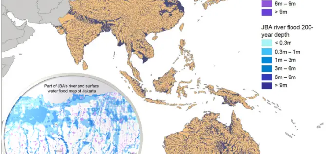
Asian Cities May See Increases in Flood Risk By 2020
Some rapidly growing Asian cities may see increases of up to 36% in the population at risk of extreme river and surface water flooding by 2020, according to recent study
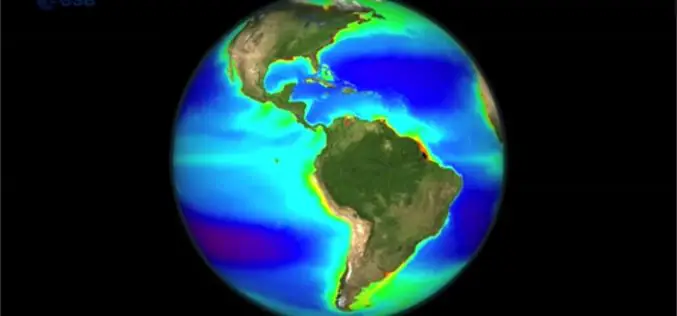
Learn the Basic about Monitoring Climate from Space
Seeing the Earth from space allows us to gain this global perspective. By using Earth observation techniques, we can now monitor global environmental change on a scale that has never
Hyperspectral Remote Sensing Reveals New Blind Geothermal System
Identification of a new blind geothermal system with hyperspectral remote sensing and shallow temperature measurements at Columbus Salt Marsh, Esmeralda County, Nevada Hyperspectral remote sensing-derived mineral maps and follow-up shallow
LizardTech Introduces National Universities Subscription Program
New program offers an enhanced learning platform for national university students around the globe LizardTech®, the creator of MrSID® and provider of software solutions for managing and distributing geospatial content,

Putting UAVs to Work: Construction Firms Utilizing Unmanned Aerial Vehicles
Putting UAVs to Work: Construction Firms Utilizing Unmanned Aerial Vehicles Date: November 18, 2015 | 1:00 PM (EST) The fascination surrounding UAVs (or drones) is undeniable, and some of the
