
Archive
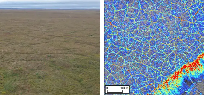
Arctic Tundra Fire Causes Widespread Permafrost Landscape Changes
ANCHORAGE, Alaska – Large and severe tundra fires cause top down permafrost thaw, playing a major role in altering Arctic landscapes according to a new study led by the U.S.
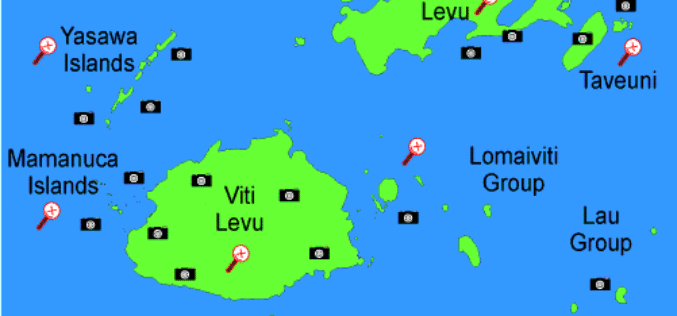
Fiji Government Assures its Commitment to Support Geospatial Industry
The Fijian Government has remained committed to the wide-spread use of geospatial technologies and to bringing Fiji’s existing technologies in line with international standards. Those were the sentiments of Prime
Abu Dhabi to Host Esri Middle East and North Africa User Conference
Emirate Serves as the Smart Government Role Model for All Nations in the Region to Replicate Redlands, California—For almost a decade, Abu Dhabi, United Arab Emirates, has typified smart government—primarily
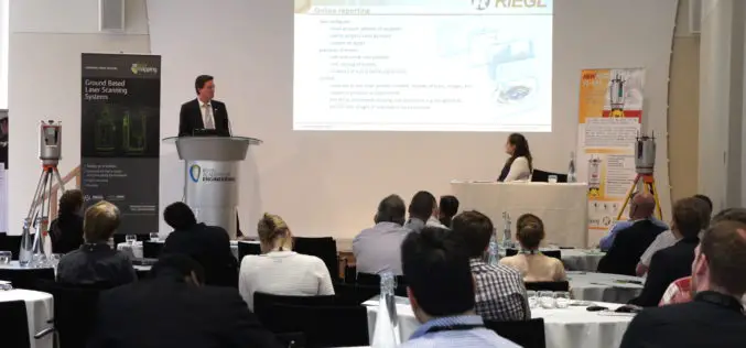
RIEGL USA Invites You to Join Terrestrial LiDAR Webinar
RIEGL USA Invites You to Our Terrestrial LiDAR Webinar 19 November 2015, 1:00 PM – 2:00 PM, Eastern Time In the fields of surveying, engineering, and construction, terrestrial LiDAR has become a

Geological Survey of India to Map Geological Potential Areas of the Country
Geological Survey of India (GSI) will soon take up the ambitious National Airborne Geophysical Mapping project covering 8 lakh sq kms including the Obvious Geological Potential (OGP) area, which includes
Vricon Introduces Groundbreaking Medium-resolution Digital Surface Model
November 10, 2015 – Vricon releases a medium-resolution global digital surface model (DSM) for $1.99 per km2 that defines a new industry standard for this product class. Vricon DSM-10 is
An Integrated Workflow for Cadastre Mapping
Disputing ownership of real estate often occurs in a country with long history. Before the modernization, people usually just roughly point out their properties by obvious and immovable landscapes, such

China’s Geoinformation Industry to Touch $6.6 Billion: Official
Beijing, Nov 10, 2015 – China’s geoinformation industry is booming with the output value expected to touch 360 billion yuan (USD 56.6 billion) this year, an increase of 22 per

SimActive Strengthens its Enterprise UAV Offering with Version 6.3
SimActive Inc., a world-leading developer of photogrammetry software, is pleased to announce Correlator3D™ version 6.3 with an expanded UAV enterprise offering. A new floating licensing option allows computers on the
Everything You Always Wanted to Know on “Digital Information in 3D”!
November 4 and 5, 2015, RIEGL attended and presented at 3D Laser Mapping’s User Conference “Digital Information in 3D” at the Prince Philip House in London. At the event, the
