
Archive

EarthSense Systems Computer Models Impact of Trees on Urban Air Pollution
Software developed by EarthSense Systems has been used to assess how trees impact on urban air quality on one of London’s most polluted streets. Called FluidAir, the state of the

Swiss Geospatial Data Now Available as Linked Data
The Swiss geoportal has started to publish geospatial data as linked data. This geoportal is harvested by the national Swiss Open Data portal, which is in turn harvested by the

Introducing Polaris – Next-Generation Terrestrial Laser Scanner
Teledyne Optech to showcase its newest and most advanced TLS at SPAR 3D March 22, 2017 — Teledyne Optech is pleased to announce the release of its Polaris Terrestrial Laser

OGC Requests Public Comment on Proposed Indexed 3D Scene Layers (I3S) Community Standard
The Open Geospatial Consortium (OGC®) is requesting public comment on the proposed Indexed 3D Scene Layers Community Standard. Indexed 3D Scene Layers (I3S) was submitted by Esri for consideration as
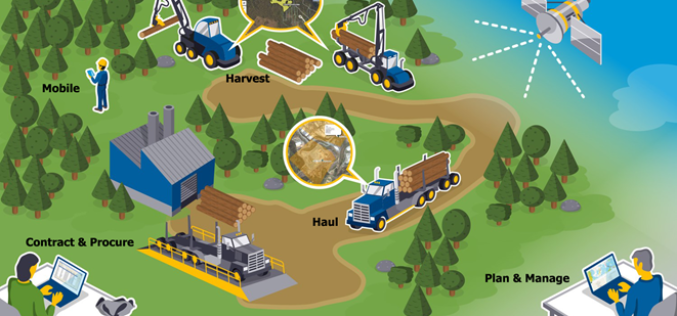
New Forests to Manage its Asian-Based AFI Investment with Trimble’s Connected Forest Solution
SUNNYVALE, Calif., March 22, 2017—Trimble (NASDAQ: TRMB) announced today that New Forests, a Sydney-based sustainable real assets investment specialist, will implement Trimble’s Land Resource Manager (LRM) solution to manage its
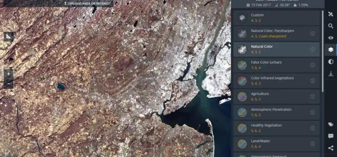
Land Viewer: On-the-Fly Earth Observation Imagery Analytics in Your Browser
Data Scientists, GIS Engineers and Software Developers from California-based company EOS have recently launched the most advanced cloud based tool to allow users, journalists, researchers, and students easily search and
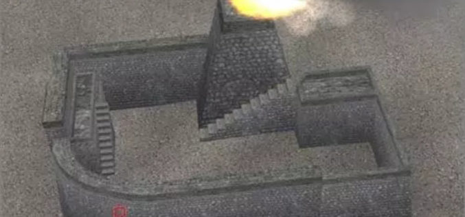
Chinese Scientists Use Remote Sensing Technology to Digitize Great Wall
Researchers from the Chinese Academy of Sciences (CAS) recently used remote-sensing equipment in their efforts to restore a vanished section of the Great Wall in Northwest China’s Xinjiang Uyghur Autonomous
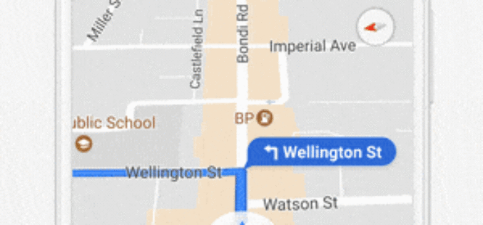
Google Maps Adds Real-time Location Sharing of Trips
Google Maps has just unveiled a new real-time location sharing feature that allows dear ones to share their location with your Google contacts, or even share with friends and family

SimActive and Tianlifa Launch Integrated UAV Solution
Montreal, Canada, March 21st, 2017 – SimActive Inc., a world-leading developer of photogrammetry software, is pleased to announce a fully-integrated solution with Tianlifa, a major firm in the Asian surveying

Esri Introduces Image Platform Bundles for Analysis, Management, and Analytics
Bundles Enable Organizations to Analyze Imagery in Minutes Instead of Hours Redlands, California—Esri, the global leader in spatial analytics, today introduced four image platform bundles that enable management and analytics
