In a groundbreaking leap for geospatial intelligence, Google’s Earth-AI is redefining how scientists, governments, and organizations analyze our planet. The system combines satellite imagery, environmental data, and population information through advanced foundation models and cross-modal reasoning. This innovation marks a major milestone in connecting artificial intelligence with Earth observation for real-world problem-solving.
A New Era of Geospatial Intelligence
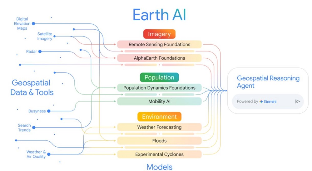
At its core, Google’s Earth-AI integrates multiple foundation models — each trained on massive datasets of satellite and aerial imagery, population distribution, and environmental changes. These models don’t just analyze visuals; they reason across multiple data types. For example, the AI can detect where floods have occurred, assess which communities are affected, and even recommend priority areas for aid distribution.
The system uses Gemini-powered reasoning agents that can process complex, multi-step queries such as, “Which areas are at risk of both heatwaves and power outages?” By combining data from its imagery, population, and environment models, Google’s technology produces answers that traditionally took analysts days to compute.
How the System Works
Three key components form the backbone of this geospatial framework:
- Imagery Model: Trained on remote-sensing data, this model identifies patterns in land cover, infrastructure, and disaster-affected regions.
- Population Model: It analyzes human mobility, density, and vulnerability patterns, offering insights into community-level risks.
- Environment Model: This layer forecasts floods, wildfires, and air quality with wide coverage — reaching over two billion people worldwide.
When a query is entered, the reasoning agent breaks it down, invokes relevant models, performs spatial calculations, and synthesises the findings into a single, coherent insight.
Also Read – How Google is Using Satellite Imagery for Mapping Wildfires?
Applications that Matter
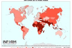
The capabilities of Google’s Earth-AI extend far beyond research labs. In disaster management, it has already improved the FEMA National Risk Index by over 11% by integrating environmental and population data. Humanitarian groups like GiveDirectly are leveraging its insights to deliver financial aid faster to flood-prone regions in Africa.
Environmental agencies and businesses are also tapping into its predictive power — from monitoring deforestation trends to evaluating infrastructure resilience against climate events. As a result, the platform is emerging as a trusted ally for sustainability planning, policy formulation, and risk assessment.
Accessibility and Future Expansion
Google has announced that these new capabilities will soon be accessible through Google Cloud and its Vertex AI platform. Researchers and developers can integrate their own geospatial data to extend the platform’s utility. Early access is being offered to organizations involved in environmental monitoring and disaster response, with broader availability expected next year.
A Transformative Step for the Planet
As the frequency of extreme weather events continues to rise, tools that bridge AI and geospatial data are no longer optional—they’re essential. Google Earth-AI provides that bridge, enabling faster decision-making and deeper planetary insights. Its cross-modal reasoning doesn’t just make maps smarter; it makes our collective response to Earth’s challenges stronger and more informed.
References:
- Google Research Blog – “Google Earth AI: Unlocking Geospatial Insights”
- Google Blog – “New Updates and More Access to Google Earth AI”
- The Indian Express – “Google Earth AI Models Aid Disaster Response”