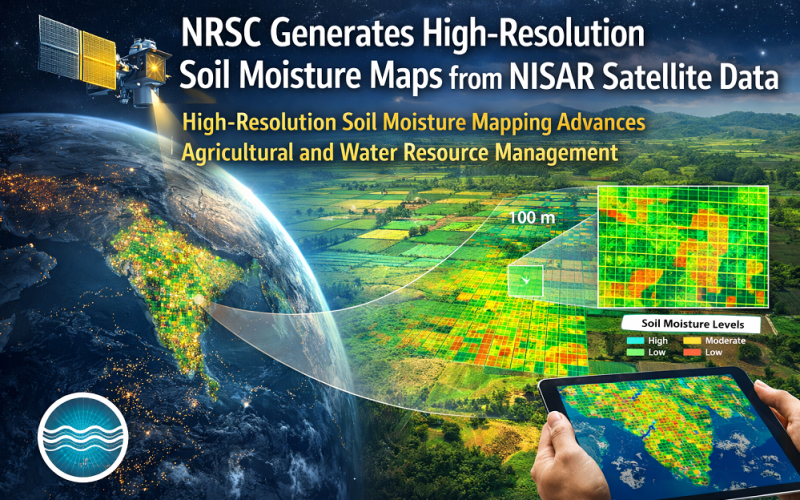
India’s National Remote Sensing Centre (NRSC), operating under ISRO, has demonstrated high-resolution soil moisture mapping at 100 × 100 metre resolution using data from the NASA-ISRO Synthetic Aperture Radar (NISAR) satellite. The product, validated over the Indo-Gangetic Plains and central India, marks a significant advance in precision agriculture and water resource management using satellite remote sensing.
Background
Launched on 30 July 2025 from the Satish Dhawan Space Centre, Sriharikota, NISAR is a joint mission between NASA and ISRO. The satellite carries a dual-frequency Synthetic Aperture Radar (SAR) system comprising an L-band instrument (1.25 GHz) contributed by NASA’s Jet Propulsion Laboratory (JPL) and an S-band instrument (3.2 GHz) developed by ISRO’s Space Applications Centre (SAC), Ahmedabad. NISAR is widely recognised as the most advanced Earth-imaging radar satellite ever launched, with a total programme cost estimated at USD 1.5 billion. The mission systematically images the Indian landmass in both S- and L-bands on a 12-day repeat cycle, providing wide-swath coverage of 242 km per pass. NRSC, based at Shadnagar near Hyderabad, serves as ISRO’s primary ground segment for Earth observation data acquisition, processing, and dissemination.
Also Read – NISAR – NASA-ISRO Synthetic Aperture Radar Mission
Technology and Methodology: Satellite Remote Sensing Soil Moisture Retrieval
The soil moisture mapping products are derived from the S-band SAR backscatter observations collected during NISAR’s ascending and descending orbits. The S-band frequency (3.2 GHz) is particularly effective for soil moisture retrieval because it penetrates sparse and moderate vegetation canopies to interact with the soil surface. NRSC scientists applied change detection and inversion algorithms to the calibrated gamma-naught (γ°) backscatter coefficients — converting radar return intensity into volumetric soil moisture values expressed in m³/m³.
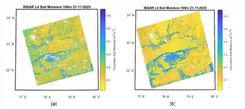
The final product delivers 100 × 100 metre spatial resolution over agricultural and mixed land-use areas, with a data latency of 48–72 hours from acquisition. The processing pipeline integrates radiometric terrain correction (RTC), co-registration of multi-temporal SAR stacks, and Water Cloud Model (WCM) vegetation correction to separate the soil moisture signal from overlying canopy contributions. Areas with dense forest, urban build-up, and permanent water bodies are flagged and excluded from the retrieval.
Implementation and Study Area
The demonstration covered key agricultural zones of central India and the Indo-Gangetic Plains — one of the world’s most productive farming regions, stretching across Uttar Pradesh, Bihar, Punjab, and Haryana. These areas experience pronounced seasonal soil moisture variability linked to the monsoon cycle. The initial dataset was generated from NISAR acquisitions collected in February 2026, with ISRO publishing the validated soil moisture product on its official website in early March 2026. The product complements the Global NISAR Soil Moisture mapping product developed by NASA at 200 metre resolution, with NRSC achieving finer resolution for the Indian landmass thanks to the S-band SAR operating in higher-resolution stripmap mode.
Applications and Impact
High-resolution soil moisture data from NISAR supports a wide range of national priorities:
- Precision agriculture: enabling variable-rate irrigation recommendations for smallholder farmers
- Drought and flood early warning systems managed by the National Disaster Management Authority (NDMA)
- Groundwater recharge monitoring under the Jal Jeevan Mission
- Climate change research and soil-atmosphere feedback modelling
The availability of free, open-access NISAR data — published within 48 hours of acquisition — democratises access to high-quality geospatial intelligence for government agencies, research institutions, and agri-tech startups across India.
Conclusion
NRSC’s achievement in generating 100-metre-resolution soil moisture maps from NISAR S-band data demonstrates the transformative potential of dual-frequency satellite remote sensing for precision land management. As NISAR builds a continuous multi-year archive, the temporal depth of its soil moisture record will underpin increasingly accurate models for agriculture, water security, and climate adaptation across the Indian subcontinent — and set a benchmark for Earth observation partnerships globally.
References
1. ISRO (2026). Soil Moisture Products at 100m resolution from NISAR data. https://www.isro.gov.in/NisarData_soil_moisture_products.html
2. NASA (2025). NASA-ISRO Satellite Sends First Radar Images of Earth’s Surface. nasa.gov
3. NASA Earthdata (2026). NISAR Beta Soil Moisture (Version 1). Alaska Satellite Facility DAAC. doi:10.5067/NIL3SME2-B1
4. Eos (2025). “Transformational” Satellite Will Monitor Earth’s Surface Changes. eos.org