Gravity reveals seafloor.
Credit: ESA
ESA’s ice mission has been used to create a new gravity map, exposing thousands of previously unchartered ‘seamounts’, ridges and deep ocean structures. This vivid new picture of the least-explored part of the ocean offers fresh clues about how continents form and breakup.
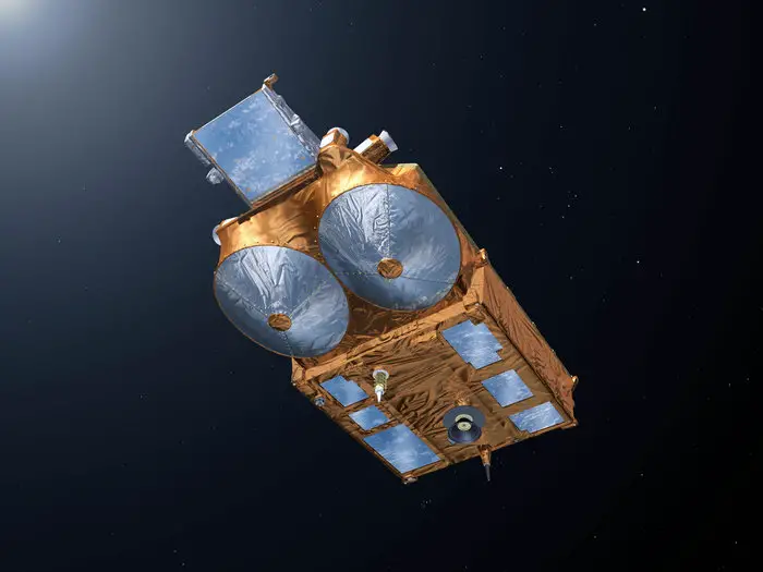
Carrying a radar altimeter, CryoSat’s main role is to provide detailed measurements of the height of the world’s ice. This allows us to see how the thickness of the ice changes, seasonally and in response to climate change.
However, CryoSat works continuously, whether there is ice below or not. This means that the satellite can also measure the height of the surface of the sea. These measurements can be used to create global marine gravity models and, from them, maps of the seafloor.
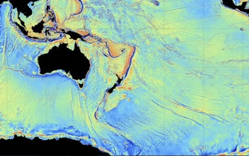
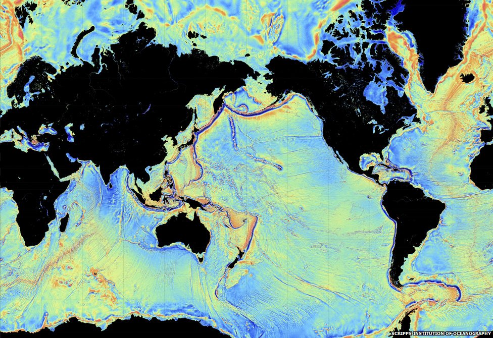
Although invisible to the eye, the sea surface has ridges and valleys that echo the topography of the ocean floor, but on a greatly reduced scale.
The effect of the slight increase in gravity caused by the mass of rock in an undersea mountain is to attract a mound of water several metres high over the seamount. Deep ocean trenches have the reverse effect.
These features can only be detected by using radar altimetry from space.
CryoSat seen from underneath node full image.
Credit: ESA
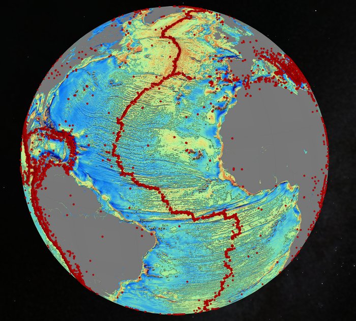
Scientists from Scripps Institute of Oceanography at University California San Diego in the US and colleagues tapped into two new streams of satellite data to create a new gravity map mirroring features of the ocean floor – twice as accurate as the previous version produced nearly 20 years ago.
They used measurements that CryoSat has captured over the oceans during the last four years as well as measurements from the French–US Jason-1 satellite, which was retasked to map the gravity field during the last year of its 12-year mission.
Atlantic bed imprinted in gravity node full image.
Credit: ESA
Combined with existing data, the new map, described in the journal Science, reveals details of thousands of undersea mountains rising a kilometre or more from the bottom of the ocean.
The new map offers geophysics new tools to investigate little-studied remote ocean basins and processes such as seafloor spreading.
“The kinds of things you can see very clearly now are abyssal hills, which are the most common land form on the planet,” said David Sandwell, lead scientist of the paper and a geophysics professor at Scripps.
The authors of the study say the map provides a new window into the tectonics of the deep oceans.
Previously unseen features in the map include newly exposed continental connections across South America and Africa, and new evidence for seafloor spreading ridges at the Gulf of Mexico that were active 150 million years ago and are now buried by layers of sediment more than a kilometre thick.
One of the most important uses of this new marine gravity field will be to improve the estimates of seafloor depth in the 80% of the oceans that remains uncharted or is buried beneath thick sediment.
The new map will also provide the foundation for the upcoming new version of Google’s ocean maps to fill large voids between shipboard depth profiles.
ESA’s Richard Francis, co-author and project manager for the development of CryoSat, said, “Although CryoSat’s primary mission is in the cryosphere, we knew as soon as we selected its orbit that it would be invaluable for marine geodesy, and this work proves the point.”
Source: ESA