
Posts From GIS Resources

World-Class Digital Photogrammetric Workstation
DAT/EM Systems International is an Alaska-based company that has been developing photogrammetric software since 1987. As a leading developer of photogrammetric hardware and software products and services, DAT/EM specializes in

Making GPS Must in Every Public Vehicle
New Delhi, India: In a move expected to improve the monitoring of public vehicles in the city, the Transport department is going to table a proposal in the Cabinet which

GPS: Solar Flares and Jamming
BBC Radio 4 describes how easy it is to jam GPS and that even solar flares can affect the navigation system. Among those interviewed in the show is Professor Catherine Mitchell of
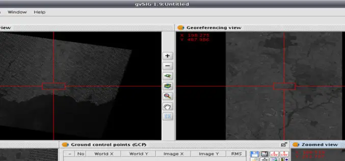
Issues to be Addressed While Georeferencing
I already have discussed about Georeferencing in my previous post on August 28, 2013. Today I am adding few more important issues that need to be considered while understanding Geo-referencing

Fundamentals of GIS
What is GIS ? GIS stands for Geographic Information System. Introduction This portion provides an overview of GIS. It examines what GIS is, what it can do and, in brief, how it

Agendra Kumar as President of Esri India
New Delhi: NIIT Technologies Ltd, a leading global IT solutions organization today announced the appointment of Mr. Agendra Kumar as the President of its joint venture subsidiary NIIT GIS Ltd
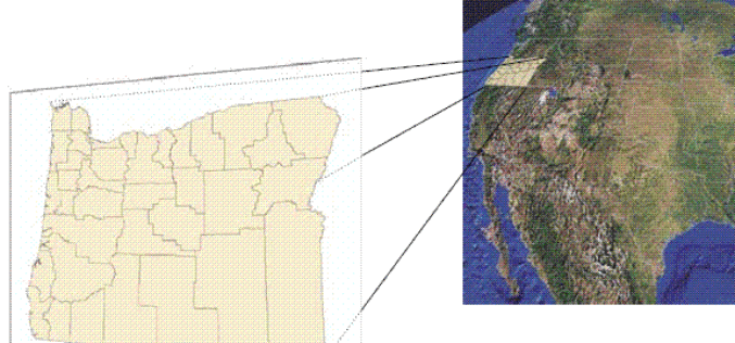
What is Georeferencing?
Today I was wondering while thinking about what I should post on GIS Resources. Then suddenly I got a click, why not about What is Georeferencing or what is georeferencing
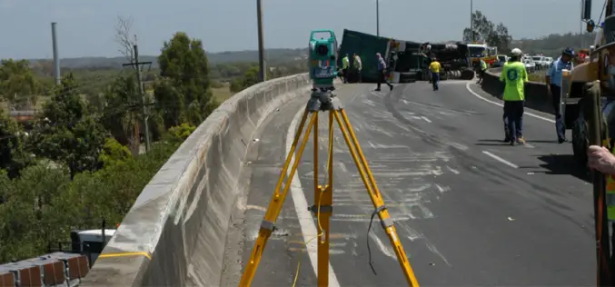
Total Station to Investigate Traffic Collision
A traffic collision, also known as a traffic accident, motor vehicle collision, motor vehicle accident, car accident, automobile accident, road traffic collision, road traffic accident, wreck(USA), car crash, or car smash (Australian) occurs when a vehicle collides with another vehicle, pedestrian, animal, road debris, or
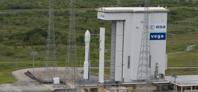
Vietnam Takes Over Control of First Remote Sensing Satellite
HANOI, Sept. 5 (Xinhua) — Control of Vietnam’s first remote sensing satellite, VNREDSat-1, has been officially handed over to the Vietnam Academy of Science and Technology (VAST) four months after

MS in Geographic Information Sciences at University of Denver
The Master of Science in Geographic Information Sciences degree (MSGISc), offered entirely online, is jointly provided by the University of Denver’s, college of professional and continuing studies, University College, and
