
Posts From GIS Resources
Important Terminologies of Photogrammetry
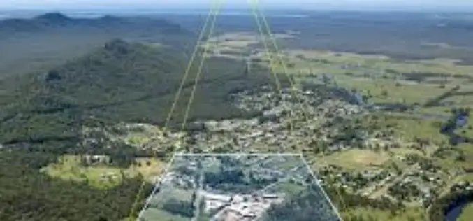
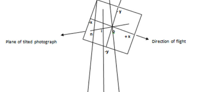
1. Vertical photograph: A photograph exposed with the optical axis of the camera coinciding with the direction of gravity or optical axis of the camera held vertical. 2. Tilted Photograph:
Basics of Photogrammetry
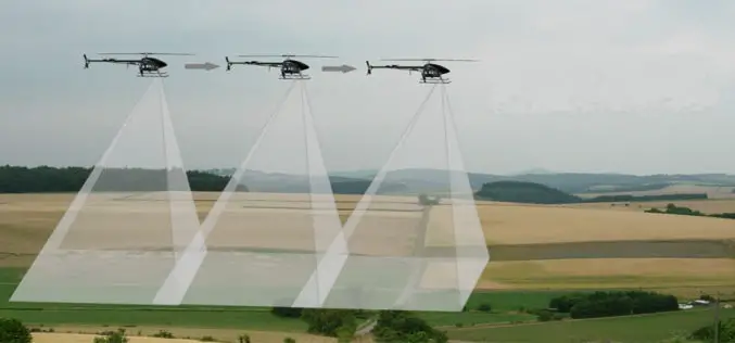
What is Photogrammetry? The classical definition of Photogrammetry is the process of deriving metric information about an object through measurement made on the photograph of the object. Photogrammetry is the
Basic Photogrammetry
The classical definition of Photogrammetry is the process of deriving metric information about an object through measurement made on the photograph of the object. Photogrammetry is the science of making
Beginning MapServer: Open Source GIS Development by Bill Kropla
Beginning MapServer: Open Source GIS Development – Bill Kropla Download Beginning MapServer: Open Source GIS Development – Bill Kropla “This blog does not host any contents or data. All the files linked to other
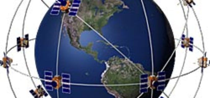
GPS Free and Open
The United States and United Kingdom have announced that the British government would end efforts to obtain patent or intellectual property (IP) rights related to GPS . The two governments
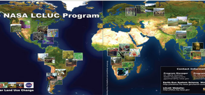
NASA Land-Cover and Land-Use Change (LCLUC) Program
Today I would like to take you for a short tour of Land-Cover and Land-Use Change (LCLUC) Program of NASA. LCLUC is an interdisciplinary science program in the Earth Science Division of

GIS Introduction & Overview by University of Missouri,Columbia
GIS Introduction & Overview by University of Missouri,Columbia This presentation/e-book provide a basic introduction about GIS. Download GIS Introduction & Overview – University of Missouri,Columbia “This blog does not host any contents or data.
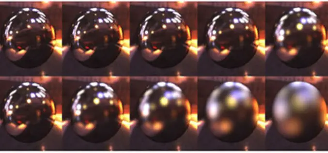
Anisotropy and BRDF
Our most of the Remote sensing is being sensed from Nadir position which is a position directly beneath the sensor, by forming a right angle from surface but various experiments

Remote Sensing and GIS Application in Agriculture
Remote Sensing and GIS Application in Agriculture (Indian Agricultural Statistical Research Institute) Download Remote Sensing and GIS Application in Agriculture (Indian Agricultural Statistical Research Institute) “This blog does not host any
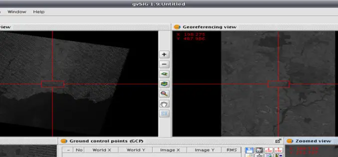
Geo-referencing ?
Today I was wondering while thinking what I should post on GIS Resources. Then suddenly I got a click, why not about Geo-referencing? It’s seems to be a very easy
