
Posts From GIS Resources

Remote Sensing of Agriculture (NASS’ Cropland Data Layer Program)
Remote Sensing of Agriculture (NASS’ Cropland Data Layer Program) Download Remote Sensing of Agriculture (NASS’ Cropland Data Layer Program “This blog does not host any contents or data. All the files linked

The New Geographers “Stories of Real People using GIS to Make a Difference” – ESRI
The New Geographers “Stories of Real People using GIS to Make a Difference” – ESRI The primary tool of the geographer is a map. What exactly is a map? A

Piksi RTK GPS Receiver Getting a Kickstart
Here’s an interesting kickstarter project that’s getting quite a kick! Enter the Piksi RTK GPS receiver, a low-cost GPS receiver boasting open source software, centimeter accuracy GPS collection, rugged design,
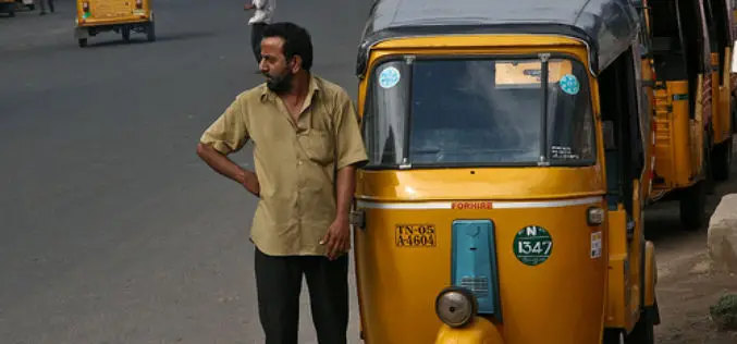
Now, Chennai autos GPS-fitted, Costlier
Chennai: In a first-of-its-kind development in the country, auto-rickshaws in Chennai will be fitted with a meter with a global positioning system (GPS) and electronic digital printer, Tamil Nadu Chief Minister
Web Maps for WordPress Plugin Connects with ArcGIS Online
Web Maps for WordPress is the best way to quickly and easily search for and insert authoritative maps directly into your blog posts and pages. Quickly and easily search and

OGP Releases P6 Seismic Bin Grid GIS Data Model
The International Association for Oil and Gas Producers (OGP, UK) has presented the OGP P6/11 seismic bin grid data exchange format. It defines parameters for a 3D seismic survey, aiming
Google releases Nexus 7 (2013) Update to Fix GPS, Touchscreen Issues
There’s a lot to like about the new Google Nexus 7 tablet. It has a high-resolution display with great viewing angles and color reproduction. It has a speedy processor. The
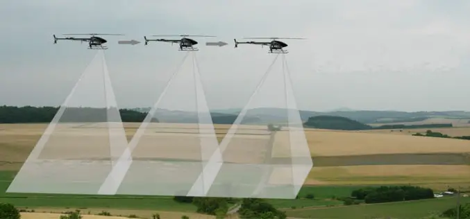
UAV System Allows GIS Professionals A Cost-effective Solution for Aerial Data
CALGARY, Alberta, Aug. 23, 2013 /CNW/ – Integrated Informatics Inc. now offers a complete aerial data solution, from data capture to analysis and data management, using senseFly’s eBee unmanned aerial
Climate Change is Indeed Faster and More Extreme Than We Feared?
When looking for “suitable” information Climate change is faster and more extreme than we feared – under this heading the British newspaper Telegraph has made in the year 2008 press
Remotely Sensing the Complexity of Rivers and Estuaries
The coasts of oceans are rich and complex environments. Over half the world’s population live on the coast or along river systems. Water resources in these regions are used for
