
GIS Data

Explore and Download Berlin 3D City Model
The 3D city model of Berlin the German capital is open to the public as Open Data. The Berlin 3D city model data plays a leading role throughout Europe in the
New ASPRS Positional Accuracy Standards for Digital Geospatial Data Released
The American Society for Photogrammetry and Remote Sensing (ASPRS) is pleased to announce the release of the new Positional Accuracy Standards for Digital Geospatial Data. The new standards are available
Esri Releases Demographic Data for 137 Countries
Global Income, Population and Business Data Now Easily Available for Better Local Market Knowledge Esri announces that geodemographic information for 57 additional countries has been added to its ready-to-use ArcGIS

Enhanced Elevation Data for North and South America, Pacific Islands, Northern Europe
New Heights of Global Topographic Data Will Aid Climate Change Research The U.S. Geological Survey announced today that improved global topographic (elevation) data are now publicly available for North and

Free GIS Data – Transport and Communications Data
Free GIS Data – Transport and Communications Data Transport and Communications Data Open Flights: Airport, airline and route data across the globe. Data is provided as CSV files which

Free GIS Data – Buildings, Roads and Points of Interest Data
Free GIS Data – Buildings, Roads and Points of Interest Data Buildings, Roads and Points of Interest Data OpenStreetMap: Crowd-sourced data for the whole world consisting of most things

Free GIS Data – Population Data
Free GIS Data – Population Data Population Data Gridded Population of the World: Includes raw population, population density, both historic, current and predicted. Global Rural-Urban Mapping Project: Based on
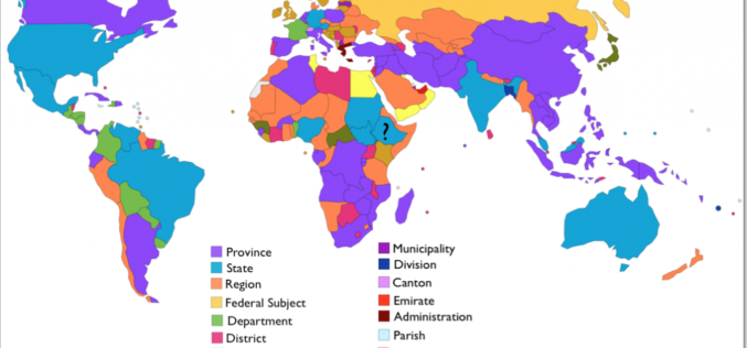
Free GIS Data – Administrative Boundaries Data
Free GIS Data – Administrative Boundaries Data Administrative Boundaries Data Natural Earth: Includes countries, disputed areas, first-order admin (departments, states etc), populated places, urban polygons, parks and protected areas

Free GIS Data – Wars, Conflict and Crime Data
Free GIS Data – Wars, Conflict and Crime Data Wars, Conflict and Crime Data ACLED: Armed Conflict Location and Event Data – containing all reported conflict events in
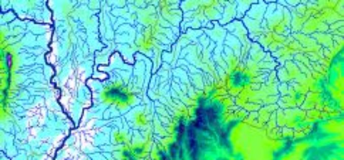
Free GIS Data -Hydrology Data
Free GIS Data -Hydrology Data Hydrology Data HydroSHEDS: Hydrological data and maps based on the STRM elevation data. Includes river networks, watershed boundaries, drainage directions and flow accumulations for
