
GIS Data
Swiss Geospatial Data Now Available as Linked Data
The Swiss geoportal has started to publish geospatial data as linked data. This geoportal is harvested by the national Swiss Open Data portal, which is in turn harvested by the
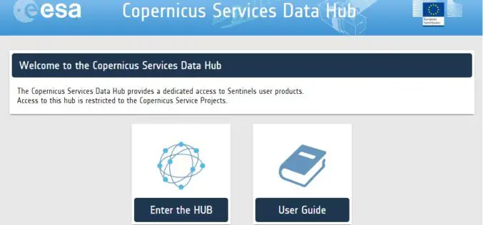
A New Sentinels Data Hub for the Copernicus Services
A new access point for the dissemination of the Sentinel products is in place for the Copernicus Service Project members: the Copernicus Services Data Hub. The Copernicus Services Data Hub initially
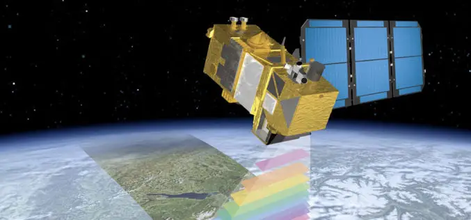
ESA Announce the Online Availability of Sentinel-2A Orthorectified Imagery
ESA is pleased to announce the availability of Sentinel-2A orthorectified products in the Sentinel Data Hub. Any products acquired from 28 November onward are available to any user. Sentinel-2 products
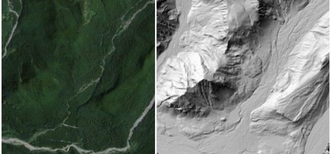
OpenTopography Releases Raster Datasets for California, Colorado, New Hampshire and Washington
Recently OpenTopography has to announce the release of seven new raster datasets. These datasets are available for areas in California, Colorado, New Hampshire and Washington. All datasets were collected between 2010 and 2012.
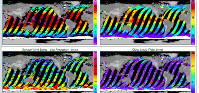
GPM Microwave Imager Data Products are Now Available to Download
Remote Sensing Systems has just released the GPM Microwave Imager (GMI) ocean product suite. The Global Precipitation Measurement (GPM) satellite has a microwave radiometer onboard called GMI (GPM Microwave Imager). The
Esri Updated Standard Global Demographic Data for 45 Countries
Esri has updated the Standard Global Demographic data for the 45 countries and is now available on the ArcGIS platform. The data is sourced from Michael Bauer Research, is available across the ArcGIS
UK Environment Agency Make LiDAR and Environment Data Open for All
The UK Environment Agency (EA) is to make its LiDAR datasets freely available as open data to commercial entities from September this year. Since 2013, LiDAR data has been published for non-commercial
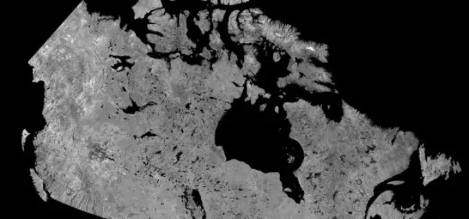
Download Free RADARSAT Data of Canada
Canada’s RADARSAT-1 is a radar satellite and was launched in November 1995. It carries a Synthetic Aperture Radar (SAR), it acquired images of the Earth day or night, in all
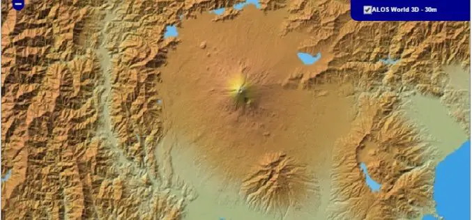
30 meter World Elevation Data is Now Available at JAXA’s Site Free of Charge!
The Japan Aerospace Exploration Agency (JAXA) will begin publishing free of charge an elevation data set that can express undulations of terrain over the world with a resolution of 30
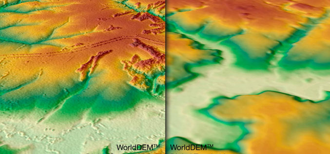
WorldDEM DTM Now Available
Precise Terrain Information Globally for Effective Analysis The WorldDEM Digital Terrain Model (DTM) is now commercially available for all users that need superior terrain information anywhere on the globe. The
