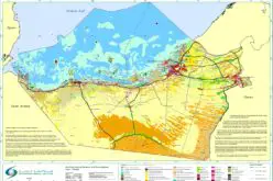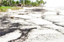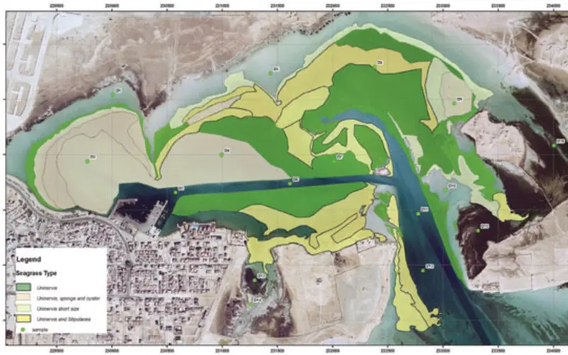

Mapping of seagrass types are now being digitally archived. Image Courtesy: Gulf Times
In a recent news by Gulf Times, Remote Sensing and Geographic Information Systems (GIS) Unit in the Environmental Studies Centre (ESC) at Qatar University has initiated the course of action to digitally archive its entire historic collection of satellite imagery, aerial photography, bathymetric data and GIS data.
Researchers from Environmental Studies Centre (ESC) of Qatar University will carry out the process of cataloging and archiving the vast amount of data holdings on Qatar (and the Gulf) marine communities, coastal waters, marine physical parameters and digital maps.
The work will be led by ESC Applied Research Department Deputy Manager Dr Nadeem Hashem and GIS specialist Julie Camy.
“The archives will also enhance the security of the data holdings which are a valuable resource for Qatar, in its efforts to build an historical environment culture and heritage as stated in the national vision and development strategies,” ESC acting director Hamad al-Saad al-Kuwari said.
“We are proud to create such an important resource that will add value to Qatar’s environmental legacy,” he added.
Source: Gulf Times