
GIS
12 Taluks of Karnataka to get Soil Condition Map
According to recent news by The Hindu Business Line, the National Bureau of Soil Survey and Land Use Planning (NBSSLUP) is working on a project to map soil in 12

India, Afghanistan to Cooperate in Space Technology
India will widen cooperation with Afghanistan in space technology by extending assistance in remote sensing, a joint statement after the 2nd Strategic Partnership Council Meeting between two nations said. India
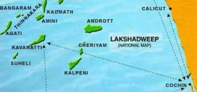
Uninhabited Lakshadweep Island Vanishes, Study using GIS & Remote Sensing
Kochi, Sep 6 (PTI) One of the biodiversity-rich uninhabited islands part of Lakshadweep has vanished due to coastal erosion and another four such territories in the sea are shrinking fast, claims

Malaysian Geospatial Master Plan to be Completed in 2018
August 22, 2017 – Putrajaya, Malaysia: The Natural Resources and Environment Ministry (NRE) is developing the National Geospatial Master Plan (NGMP) towards realising the potential of geospatial technology, in line with the

Telangana: Land Registry of all ULBs Completed
August 23, 2017 – According to recent news by The Indian Express, the Integrated Urban Land Registry (IULR) for 72 Urban Local Bodies (ULBs) (other than GHMC) will soon be uploaded
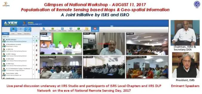
National Workshop on Popularisation of Remote Sensing Based Maps and Geo-spatial Information
August 22, 2017 – A National Workshop on Popularisation of Remote Sensing Based Maps and Geo-spatial Information was organised jointly by ISRS and ISRO on the eve of National Remote Sensing
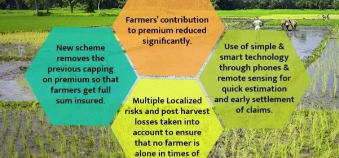
PM Modi Reviews Progress of Soil Health Cards and Pradhan Mantri Fasal Bima Yojana
In the Kharif season of 2016 and Rabi season of 2016-17, claims of over Rs. 7700 crores paid PMFBY: Over 90 lakh farmers benefitted August 21, 2017 – India, The
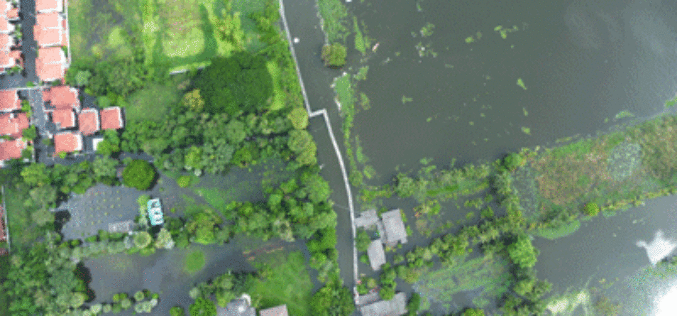
Tamil Nadu Government Started UAV Survey to Map Flood-Prone Areas
According to recent news by The Hindu, the Tamil Nadu Government in association with Anna University has launched an Unmanned Aerial Vehicle (UAV) for Photogrammetric mapping of water resources in Cuddalore
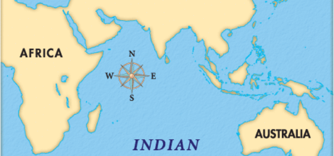
Indian Ocean Level Rising Faster Than Compared to the Global Estimate
IANS – New Delhi: Global warming is leading to an accelerated rise of the sea level in the north Indian Ocean as compared to the global estimate, Parliament was informed on

Esri Story Map: Unusual Indian Weddings that Challenged Stereotypes
Contributed By:- Here are the wedding stories of young couples and their families who dared to fight stigmas and break stereotypes. These stories rekindle faith in humanity and leave you
