
GIS
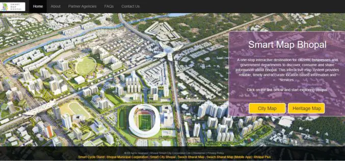
Smart Map Bhopal: A City Level Web-Based GIS solution
Smart Map Bhopal is an enterprise-wide web-based GIS solution created using ArcGIS platform and seamlessly functions across various the web & mobile devices. GIS System will provide
Mobile App for Road Maintenance “Aarambh” Launched
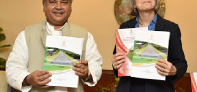
PIB – The visiting ILO Deputy Director General (Policy) International Labour Organization Ms. Deborah Greenfield, who is on an official visit to India called on Hon’ble Shri Narendra Singh Tomar,
USGIF Universal GEOINT Certification Program
USGIF has launched a first-of-its-kind, transparent, and transportable Universal GEOINT Certification Program and professional designation that proves your deep and balanced understanding of the GEOINT tradecraft. The goal of the Universal GEOINT Certification Program is to provide
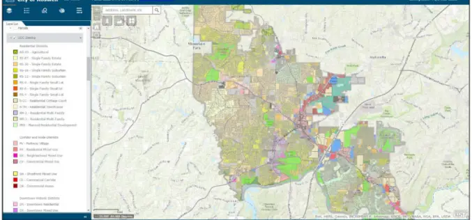
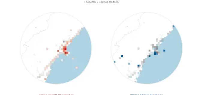
City of Roswell: A Case Study – Creating and Maintaining a GIS Enterprise
Introduction The bustling City of Roswellhas seen its population increase substantially over the course of the last twenty years, becoming the eighth largest city in the State of Georgia. Although
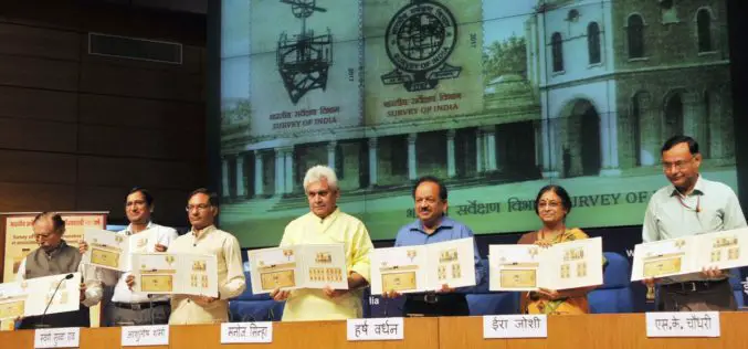
Survey of India Strives to Keep India Among the Best Surveyed Countries in the World-Manoj Sinha
Survey of India Strives to Keep India Among the Best Surveyed Countries in the World-Manoj Sinha Commemorative postage stamp released on 250th anniversary of Survey of India Minister of Communications

Are You a Yoga Enthusiast? “Yogamplify” is Your One Stop Destination to Explore Events and Activities
21st June is celebrated as the International Day of Yoga, celebrated by millions at multiple venues across the world. Indian Prime Minister Narendra Modi introduced the idea of an International
Facebook Launches Disaster Maps to Help Communities Recover and Rebuild
According to recent news by the Facebook Newsroom, Facebook is introducing disaster maps that use aggregated, de-identified Facebook data to help organizations address the critical gap in the information they often
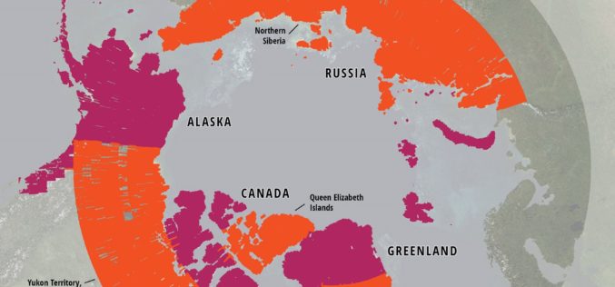
ArcticDEM Project Has Now Mapped More Than 65 Percent of The Arctic
ArcticDEM Release 5 represents the largest release of elevation data to date, more than doubling the number of available strip DEMs, mosaic tiles and geographic coverage area of all releases
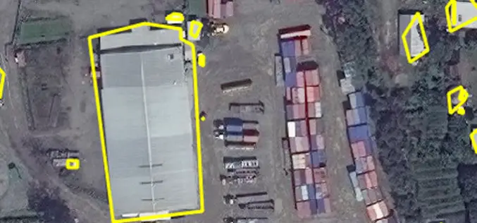
East View Geospatial Enhances Training Data Accuracy for Automated Feature Identification in Machine Learning Trials
MINNETONKA, Minnesota, USA, 1 June 2017 – East View Geospatial (EVG), a provider of content-rich cartographic products, continues to enhance the accuracy of automated feature identification using its newly developed

The Benefits and Challenges of UAVs
Ohio University Online The Federal Aviation Administration predicts that by 2017, the market for military UAVs will surpass $10 billion, while the Association for Unmanned Vehicle Systems International believes that
