
GIS
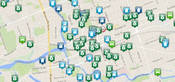
Crime Mapping Tool for Better Crime Monitoring
Bair Analytics Inc. will be providing online crime mapping service to the London Police Service and public. Each occurrence is represented by an icon that, when selected, will reveal information about each
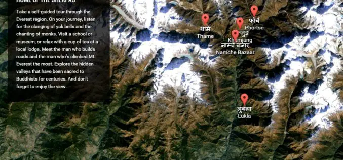
Climb the Mount Everest with Google Street View
Google has added the Khumbu region of Nepal, famously known as the Mount Everest region, to its Street View with extensive mapping and photographs. Google has now taken street view
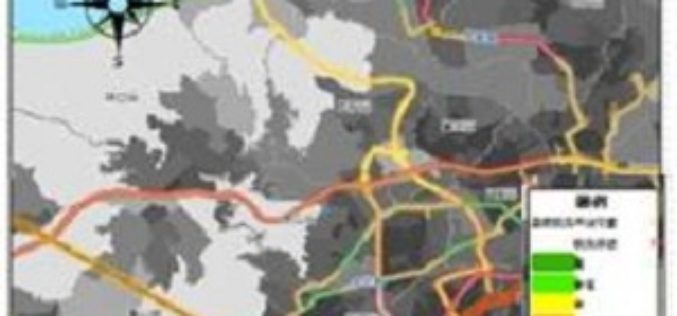
Climate Change Vulnerability Index System
To handle climate changes and reduce the loss of lives and properties, Taiwan government establishes a SuperGIS-powered platform, to provide latest information to support decision making. To address climate changes

A World Showcase to Celebrate Ordnance Survey’s Work in London
The largest ever model of Central London, commissioned by New London Architecture and sponsored by Ordnance Survey, will be unveiled for the first time on the London Stand at MIPIM,
Rwanda Launches the First-Ever Land Use Portal in Africa
Esri Eases Access to Land Information for Rwandan Citizens and Planners Redlands, California—Thanks to a new website called the National Land Use Planning Portal (NLUPP), Rwandans connected to the Internet

European Space Agency (ESA) Conducting Ocean Training Course 2015
As part of the Scientific Exploitation of Operational Missions (SEOM) programme element, the European Space Agency (ESA) is organising an advanced Ocean Remote Sensing Training Course, devoted to train the
Supergeo Expand Partnership with Géo.RM, France
Supergeo Technologies, the global leading GIS software and solution provider, announced the renewal of SuperGIS software contract with Géo. RM, France. The extended collaboration will continue bringing French-speaking users the
FOSS4G-Europe Conference – Submissions Deadline Extended!
The second edition of the FOSS4G-Europe Conference will be held at Politecnico di Milano in Como, Italy, from July 15th to 17th, 2015. A day of workshops will precede the

RIEGL LIDAR 2015 – New Sponsors and First Speaker Announcements!
RIEGL LIDAR 2015 May 5-8, 2015 in Hong Kong and Guangzhou (Canton), China Presentation slots and seats for RIEGL LIDAR 2015 are filling up fast! New sponsors and exhibitors have
Independent Report Highlights Esri as Leader in Global GIS Market
Esri and Partners Lead GIS Deployment in More than 10 Industries, Including 28 Percent Share of Electric Transmission and Distribution Market Redlands, California—ARC Advisory Group reports that Esri has a
