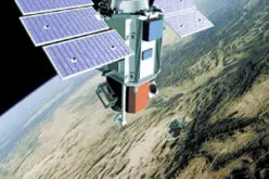
 As part of the Scientific Exploitation of Operational Missions (SEOM) programme element, the European Space Agency (ESA) is organising an advanced Ocean Remote Sensing Training Course, devoted to train the next generation of Earth Observation (EO) scientists to exploit data from ESA and operational EO Missions for science and applications development.
The Training Course is co-sponsored by the French Research Institute for Exploitation of the Sea – IFREMER; Brest (France) from 7-11 September 2015.
Participation
Post graduate, PhD students, post doctoral research scientists and users from European countries and Canada interested in Ocean Remote Sensing are invited to apply to the 5 day course on the subject.
Research scientists and students from all other countries are also welcome to apply and participate to the course subject to space availability
No participation fees will be charged for the training but participants are expected to cover their own travel and accommodation expenses (financial support is not available).
The official language of the training course is English. Participation will be limited to 50 students.
Objectives
The Advanced Ocean Training Course aims at:
- Training the next generation of European and Canadian EO scientists and Principal Investigators (PIs);
- Explaining theoretical principles of Ocean Colour Radiometry, SST retrievals, SAR and Radar Altimetry principles and applications;
- Introducing tools and methods for the exploitation of EO satellite data;
- Stimulating and supporting the exploitation of the ESA Earth Explorer missions and the Sentinels for ocean remote sensing science and applications
The training course will include formal lectures as well as hands-on computing exercises using SAR, Optical, IR and Altimeter data.
The training course is devoted to applications of ESA EO data and information retrieval using optical, IR, SAR and Radar Altimeter data.
The course will include formal lectures by leading scientists as well as hands-on practical exercises allowing students to work with SAR, Optical, Thermal and Radar Altimeter data.
Lectures
- ESA satellite missions for ocean remote sensing including Envisat, the Earth Explorers, Sentinels -1 and -3;
- Remote sensing principles in ocean colour Radiometry, Sea Surface Temperature and Ocean Salinity retrievals, SAR and Radar Altimetry principles and applications;
- Exploitation of instruments´ synergy;
- Global satellite data products for climate research and modelling
Practical Sessions
- Usage of software tools for examining data sets from (A)SAR, RA, MERIS,(A)ATSR and SMOS instruments;
- Interpretation of signatures from these instruments and their transformation into geo-physical products.
Important Dates
Complete Application Submission with uploaded reference letter (closing): 01 February 2015
Notification of Acceptance: 30 June 2015
Read more about conference click here