
Business

PCI Geomatics Releases Linux Versions of Geomatica 2014
RICHMOND HILL, Ontario, Canada—August 7, 2014: PCI Geomatics, a world leading developer of geo-imaging software and systems, today announces the release of three Linux versions of Geomatica 2014, the latest

OGC Publishes Tested 10 Open Mobility Location Standards Engineering Reports
19 public Engineering Reports resulted from the Open Geospatial Consortium’s (OGC®) OGC Testbed 10, the most recent in the OGC’s yearly series of major geospatial interoperability testbeds. Six of these reports

Philippine National Irrigation Systems Upgrades Parcel Maps by SuperGIS Desktop
Supergeo Technologies, a leading global provider of GIS software and solutions, announces that Philippines National Irrigation Systems (NIA) upgrades the country’s parcellary maps through SuperGIS Desktop to elevate the efficiency
SuperGIS Spatial Statistical Analyst 3.2 Released Globally
Supergeo Technologies, a leading global provider of GIS software and solutions, officially launches SuperGIS Spatial Statistical Analyst 3.2 with powerful functions and optimization of interface for worldwide users. SuperGIS Spatial

Ordnance Survey: New off-Road Cycle Trail Maps Launched in Hampshire
Ordnance Survey has identified Hampshire as one of the nation’s main cycling hubs and has developed a set of mapping packs containing a range of off-road routes, enabling cyclists to explore

Maps.com Launches “Field Trip Library” for K–12 Students
Interactive Exercises Based on the Esri Story Map Platform Redlands, California— (GIS) concepts while exploring global culture, regional patterns, and major historical events through interactive maps. Field trips are enhanced with
GFK’S New Digital Maps of China Point The Way To Regional Turnover Potential
Bruchsal, Germany, July 31, 2014. – GfK has expanded and updated its digital maps for China. This includes an unprecedented six-digit postcode map for China’s ten largest cities. GfK’s detailed
New Esri Book Proposes Changes to US Land Records System
Modernizing American Land Records: Order upon Chaos Provides a Comprehensive View of the System’s Problems and Possible Solutions Redlands, California—Modernizing American Land Records: Order upon Chaos examines the history of American
Supergeo to Provide Free Online GIS Web Courses
To well promote GIS technologies in real case application, Supergeo is going to provide free online GIS web courses. From basic to advanced, the courses will introduce GIS software on
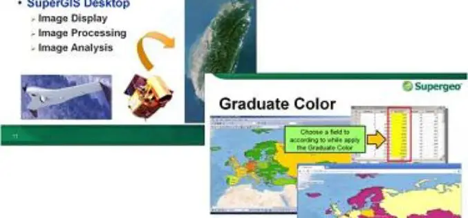
Hong Kong Polytechnic University Empowers GIS Analyst with SuperGIS Desktop
Supergeo Technologies, the leading global provider of GIS software and solutions, announces that Hong Kong Polytechnic University (HKPU) selects SuperGIS Desktop through Star Vision, Supergeo certified reseller, to educate the
