
Software

PR: Now Add Location Intelligence to Apps with MapmyIndia Map APIs
18th March, New Delhi: MapmyIndia today announced the public launch of its Map API platform for software developers and enterprises. MapmyIndia’s API (Application Programming Interface) platform consists of individual APIs
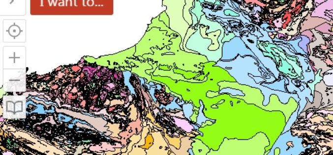
WA Geology – A Geology Mapping App for Mobile Devices
The Government of Western Australia has launched a mobile app for geology mapping. The mobile app WA Geology – is a web-mapping application that requires use of a wide variety

PCI Geomatics Releases GXL 2015
PCI Geomatics, a world leading developer of remote sensing and photogrammetric software and systems, announced today the release of its GeoImaging Accelerator (GXL) 2015 – the latest version of the

SuperPad Reveals NTRIP Solution to Achieve Centimeter Level Accuracy
Supergeo, the leading GIS software and solution provider, is going to release NTRIP solution on its Windows Mobile GIS app, SuperPad, for high accurate field data collection and geospatial workflow

PCI Geomatics Implements Support for KazEOSat-1
MARKHAM, Ontario, Canada—February 25, 2015: PCI Geomatics, a world leading developer of remote sensing and photogrammetric software and systems, announced today that it has implemented support for KazEOSat-1, an Earth

New Stable Version of GRASS GIS 7.0.0 is Released
After many years of development the new stable major release GRASS GIS 7.0.0 is available. The graphical user interface based on wxPython has been enriched with many new features in
Orbit GT Direct Export included in RIEGL RiPROCESS Release
Orbit GT and RIEGL are pleased to announce the RIEGL’s newest release of RiPROCESS standard includes direct export to the Orbit software portfolio. “We are very pleased that RIEGL has

High Accuracy and Advanced Field Work with Latest SuperSurv
To meet the great needs of high accuracy field data collection and better workflow via modern GNSS technology, Supergeo, the leading GIS software and solution provider, announces the latest SuperSurv
DAT/EM Summit Evolution Compatible with Blue Marble’s Global Mapper
The new Global Mapper Extension from DAT/EM Systems International connects Global Mapper from Blue Marble Geographics® with any edition (Professional, Feature Collection or Lite) of DAT/EM’s famous Summit Evolution™ stereoplotter.

Esri India Launches Smart Planning Tools for Smart Cities
Mumbai, India – Esri India (a joint venture between NIIT Technologies Limited, and Esri Inc.), country’s leading Geographic Information System (GIS) Software & Solutions provider, shared details of its offerings
