
Software
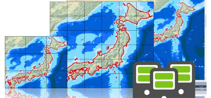
Brand New SuperGIS Desktop 3.3, Now Released for Worldwide Users!
SuperGIS Desktop 3.3, the powerful GIS software developed by Supergeo, is officially released! The latest version enhances map drawing, geodatabase, cache generator and data processing functions. By using SuperGIS Desktop
Evolve! New Techs for Developer GIS, Meet the Latest SuperGIS Engine 3.3
Supergeo Technologies, the leading global provider of complete GIS software and solutions, officially released SuperGIS Engine 3.3 for global GIS developers to customize GIS applications, meeting diverse demands in various

New LASliberator “frees” LiDAR from Closed Format
The latest product by rapidlasso GmbH – creators of LAStools and LASzip – is an open source tool aiming to liberate LiDAR points locked-up in proprietary “Optimized LAS” – a highly controversial, closed LiDAR format. The new LASliberator can

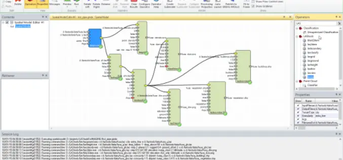
New Point Cloud Capability with SimActive Version 6.1
SimActive Inc., a world-leading developer of photogrammetry software, is pleased to announce Correlator3D™ version 6.1, now with point cloud generation. The new feature builds on SimActive’s world-renowned autocorrelation techniques using

Vector based Spatial Analysis using TdhGIS
TdhGIS is an open source spatial analysis tool data based on vector geometric data. TdhGIS has an open database structure and the ability to import and export common file formats, including
PR: LAStools Toolbox for ERDAS IMAGINE 2014 Released
The latest release of LAStools from rapidlasso GmbH contains a new toolbox for ERDAS IMAGINE 2014, allowing the users of Hexagon Geospatial’s powerful remote sensing software to utilize the popular rapidlasso LiDAR processing modules. The tools
TerraGo Publisher Version 6.7 Delivers Free GIS-Lite Applications from ArcMap
TerraGo Publisher for ArcGIS is an extension to Esri ArcGIS that allows you to produce and exploit GeoPDF documents with ArcMap. You can define global defaults to be used when
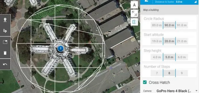
3D Robotics (3DR) Announces DroneKit SDK and API for Developing Drone Apps
3D Robotics (3DR), North America’s largest consumer drone manufacturer, has released a new open software product called DroneKit – Software Development Kit (SDK) and Application Programming Interface (API) for drone app development. DroneKit allows developers

PostGIS Has Released New Version PostGIS 2.1.6
The PostGIS development team is happy to release patch for PostGIS 2.1, the 2.1.6 release. As befits a patch release, the focus is on bugs, breakages, and performance issues. Users

PR: Global Mapper SDK v16.1 Released with Faster Display of Online Data Sources
Hallowell, Maine – March 24, 2015 – Blue Marble Geographics (bluemarblegeo.com) is pleased to announce the release of the Global Mapper Software Development Kit (SDK) version 16.1. This release features
