
Software
Insights to SuperGIS Server 10
Supergeo is going to upgrade all the products to a new level, the 10 series, including SuperGIS Server. The most exciting thing in SuperGIS Server 10 is its integration of

Celebrate Google Earth 10 Birthday with Two New Features
Happy Birthday, Google Earth! It has been a full decade to the launch of Google Earth, has provided the capability to visualize and analyze geographic data for various scientific applications
OpenGeo Suite 4.6.1 Now Available
Boundless is announcing the general availability of OpenGeo Suite 4.6.1 for all customers and OpenGeo Suite users. This is a patch release primarily intended to address an identified security vulnerability

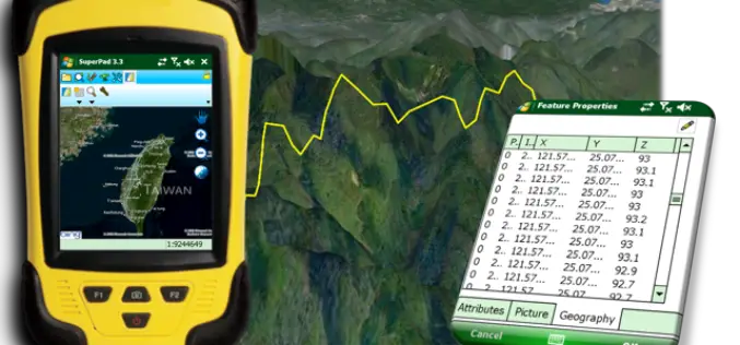
TerraGo Edge Ups the Ante for Mobile Surveying with High-Precision GPS and Advanced Mapping Features
TerraGo Edge Version 3.6 provides advanced support for EOS and SXBlue High-Precision GNSS receivers on iOS and Android, adds new mobile surveying features, new basemap sources and integration with Google Earth. New
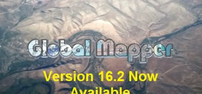
Global Mapper Version 16.2 Now Available with Improved 3D Viewer, Upgraded Fly-Through Video Playback, and Numerous New Formats
Hallowell, Maine – May 19, 2015 – Blue Marble Geographics (bluemarblegeo.com) is pleased to announce the availability of version 16.2 of Global Mapper. This interim release includes functional upgrades and

New South Wales Has Launched an App to Rejuvenate History of Towns
New South Wales in Australia has launched an app for residents to learn about the history of their local towns. Towns Through Time was created by Bathurst based developers Appiwork as
Boundless Releases OpenGeo Suite 4.6
Latest Version of Leading Open Source Geospatial Software Improves Styling, Performance, and Reliability New York, NY & Washington, DC – May 12, 2015 — Boundless, the leading provider of Spatial
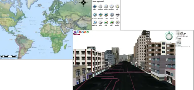
Perfection and Profession. Meet the Brand New SuperPad 3.3!
It is really our pleasure to share with you that the latest version of the SuperPad released for global users. Supergeo R&D team have been focusing on usability and reliability
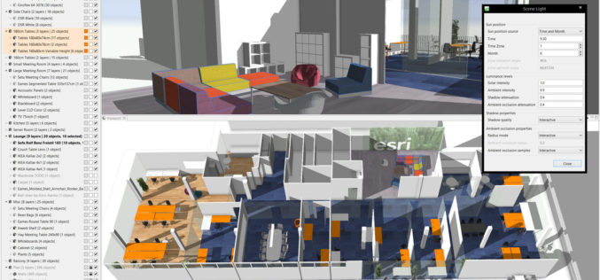
Esri CityEngine 2015 Provides Advanced 3D City Design
New Features Provide a Faster, More Intuitive Experience for Modeling Virtual 3D Urban Environments Redlands, California—The release of Esri CityEngine 2015 allows GIS professionals, architects, planners, and urban designers to

PCI Geomatics Announces Release of Geomatica 2015
MARKHAM, Ontario, Canada—April 28, 2015: PCI Geomatics, a world leading developer of geo-imaging software and systems, today announces the release of Geomatica 2015; the latest version of the company’s complete
