
Software
LandScape 7.4: Faster Point Cloud Loading, Change Detection Tools & VR Option
DAT/EM Systems International Updates Landscape Software to Deliver Faster Point Cloud Loading and Change Detection Tools Version 7.4, with Virtual Reality Option, to be Demonstrated at Esri Events in San

Global Mapper LiDAR Module v18.2 Now Features Hydro-Flattening Capability
Blue Marble Geographics has recently announced the release of Global Mapper version 18.2, the latest edition of the Module includes support for hydro-flattening from 3D lines or polygons when creating
Spanish Language Version of Global Mapper Now Available
Hallowell, Maine – June 19, 2017 – Blue Marble Geographics (www.bluemarblegeo.com) is pleased to announce that a Spanish language version of Global Mapper is now available. Developed in partnership with the company’s certified
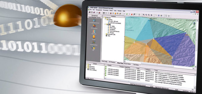
Leica Geosystems’ GNSS Networks Now Support Galileo, QZSS
(Heerbrugg, Switzerland, 16 June 2017) Leica Geosystems, industry leader in measurement technology, released Leica Spider v7.0 software suite, supporting Galileo and QZSS constellations as well as the GPS-L5 signal for
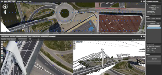
Orbit GT Releases UAS Mapping v17.1 With Cloud Upload Feature at UAV EXPO, Brussels
Orbit GT releases v17.1 of its UAS Mapping desktop product including the all-new Upload to the Cloud feature. It is available for download today from our website www.orbitgt.com. “This upgrade includes

Leica Cyclone REGISTER 360, Cloud Services offer speed, scale and simplicity to the digital reality capture market
15 JUNE 2017 – Hexagon, a leading global provider of information technology solutions, announced today its new Leica Cyclone REGISTER 360 laser scanning software for simpler, automated registration, and its Cyclone

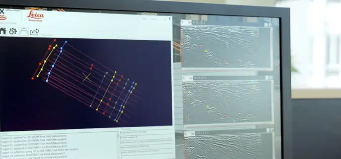
Leica Geosystems Introduces Imagery, Live Video Stream to Monitoring
Leica GeoMoS Imaging increases productivity, reduces time in the field (Heerbrugg, Switzerland, 13 June 2017) – Leica Geosystems, industry leader in measurement technology, announced today Leica GeoMoS Imaging, a monitoring
New Utility Post Processing Software Delivers CAD Drawings in Less Time with Professional Results
Leica DX Office Vision enables non-experienced CAD users to digitally map detected underground utilities (Heerbrugg, Switzerland, 14 June 2017) – Leica Geosystems, industry leader in measurement technology, released today its
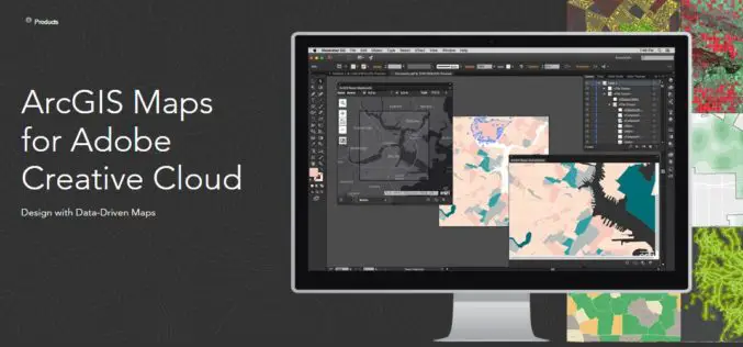
Esri Announce the Release of ArcGIS Maps for Adobe Creative Cloud!
The ArcGIS and Adobe® integration opens GIS up to an expanding group of design- and communications-focused users, who can now make direct use of spatial information. Cartographers can have the
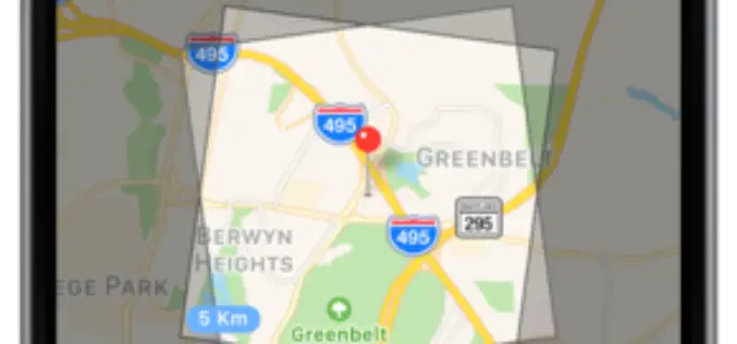
SAR and 40cm Optical Satellite Imagery Tasking With SpyMeSat Mobile App
GREENBELT, MD (June 1st, 2017) – Orbit Logic announced today that SpyMeSat mobile app users can now send new tasking requests to the KOMPSAT-5 Synthetic Aperture RADAR (SAR) imaging satellite
