
Software

Global Mapper LiDAR Module v18 Now Available with Full Range 3D Point Cloud Display
Blue Marble Geographics is pleased to announce the availability of an update to the Global Mapper LiDAR Module. Released in conjunction with Global Mapper version 18 the latest edition of

PDF3D Announces Support for macOS Sierra
Advanced 3D PDF authoring software suite supports the latest Macintosh® OS release. London, UK, October 27th, 2016 – PDF3D, from Visual Technology Services, today reaffirmed its commitment to Apple technology

DataMapper Launches New Drone Data App – Waterpooling App
In the aftermath of an extreme rain event, insurance adjusters and growers have had to spend a significant amount of time in the field to approximate the extent of damage.
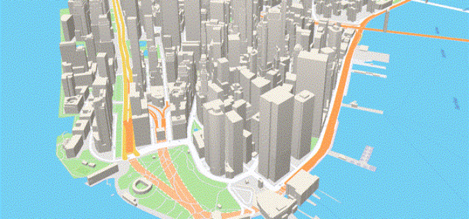
Mapbox Added 3D features in Mapbox GL JS
Mapbox added 3D features to Mapbox GL JS to take your maps to new heights! With the new extrusion properties, we can render 3D buildings/3D visualizations, visualize elevation profiles, build
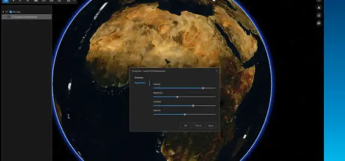
ArcGIS Earth Just Got Even Better With Launch of ArcGIS Earth 1.3
ArcGIS Earth 1.3 with Control Vertical Exaggeration and Image Properties With ArcGIS Earth 1.3 you can now do more with terrain, imagery, and KML. You will also discover authentication improvements

Global Mapper v.18 Now Available with Improved User Interface and Full Range Rendering of 3D Data
Blue Marble Geographics is pleased to announce the immediate availability ofGlobal Mapper version 18 . The culmination of an extensive design and development effort, this major version release boasts a
SuperGIS Server 3.3 Is Now Released!
SuperGIS Server 3.3.0001, the latest version of SuperGIS Server is now released! In this version, the most distinguishable feature will be the new ultra application, which has not only a
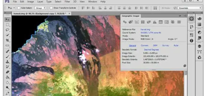
Avenza Releases Geographic Imager 5.1 for Adobe Photoshop
GeoPackage now a supported format Toronto, ON, September 13, 2016 – Avenza Systems Inc., producers of the Avenza Maps app for mobile devices and geospatial plug-ins for Adobe Creative Cloud,
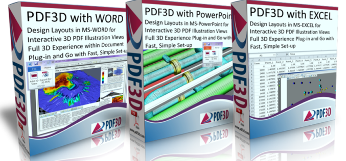
PDF3D Releases Microsoft OFFICE Enhancements with 3D Plugins
New plugins from PDF3D allow Microsoft Office users to enhance documents by adding interactive 3D images at the click of a button. London, UK, September 9th, 2016 – PDF3D, the

Enhanced Imagery, Modelling, Volumes Improve Productivity With LISTECH Neo
LISTECH, a Hexagon Geosystems brand, today announced increased functionality to its new geospatial software Neo, with terrain modelling, volume calculation and imagery offerings. With an integrated 3D/2D environment for viewing
