
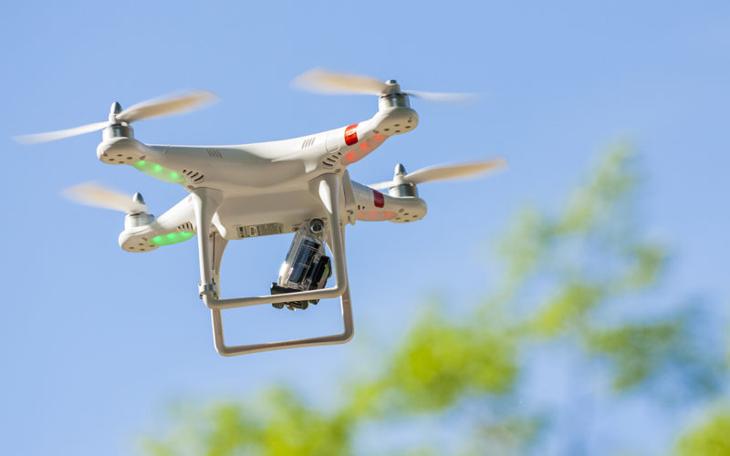

The first phase of the ‘Udaan’ mission is now complete; with data gathered for all parts of Sohna has very high resolution of 5 cm
According to recent news by The Economic Times, drones was used to complete a minute drone aerial mapping exercise of Sohna town, Gurgaon (near NCR), to create new age administrative tools. The mapping will assist the administration for checking on encroachments, collecting property tax and urban planning.
The first phase of the ‘Udaan’ mission is now complete; with data gathered for all parts of Sohna has a very high resolution of 5 cm, which is ten times sharper than that available from latest satellite. District officials say the project is now being used to map out parts of Gurgaon where it will create a smart grid system – a defined area that will have uninterrupted electricity supply.
The pilot project, which the district administration says is a first of its kind in the country, involved several government bodies, including the Haryana Space Application Center and the Pune Science and Technology Park.
The data and detailed imagery collected will primarily be used as governance tools for forest cover detection, pollution control, land planning and property tax collection.


Drone Mapping is advanced and good to have the accurate data however; the Government should not allow any private company to operate the drone for any purpose. Drones will be the biggest security threats in the future and it is headache even for Anti-Missile Defense System to track and destroy in case drone carries warheads by enemies. Hence, the NCR is most important place in the country and NCR should be well protected.