
Tag "land-cover"
ARSET Advanced Webinar: Land Cover Classification with Satellite Imagery
Advanced Webinar: Accuracy Assessment of a Land Cover Classification Dates: Tuesday, February 13, 2018 to Tuesday, February 20, 2018 Times: 11:00-13:00 and 23:00-01:00 EST (UTC-5) In last year’s ARSET Advanced Webinar: Land Cover Classification
UN-GGIM: Europe – Research Identifies 14 ‘Core’ INSPIRE Themes for Global Sustainable Development Goals
The scope of geospatial data extends far beyond environmental, social and economic analysis, a study by UN-GIMM: Europe has found. Research by the Regional Committee of Experts shows that information
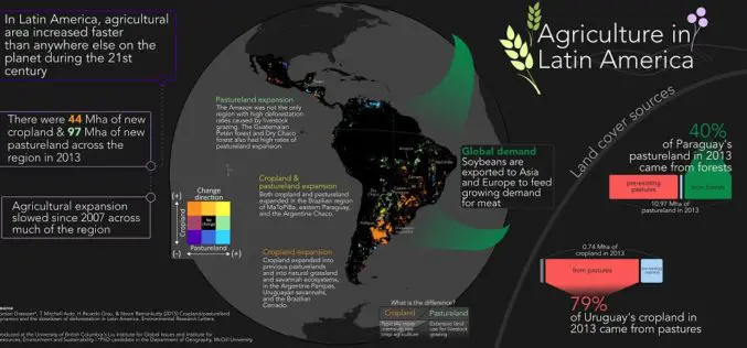
Remote Sensing to Study Dynamics of Cropland in Latin America
In a study, “Cropland/pastureland dynamics and the slowdown of deforestation in Latin America,” published in Environmental Research Letters by Jordan Graesser and et. al., brings out some interesting facts about
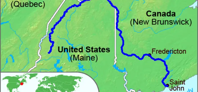
High-Precision Land-Cover-Land-Use GIS Mapping and Land Availability and Suitability Analysis for Grass Biomass Production in the Aroostook River Valley, Maine, USA
High-Precision Land-Cover-Land-Use GIS Mapping and Land Availability and Suitability Analysis for Grass Biomass Production in the Aroostook River Valley, Maine, USA – Chunzeng Wang , Jason Johnston, David Vail, Jared Dickinson and
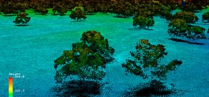
Full Waveform LiDAR Sample Data Now Available For Free
In a recent announcement by NEON, NEON Airborne Observation Platform (AOP) sample data is now available on the Airborne Data page. The NEON Airborne Observation Platform (AOP) is an aircraft
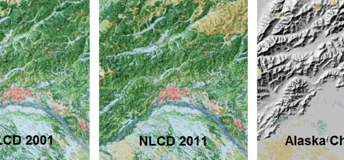
A Decade of Change in America’s Arctic: New Land Cover Data Released for Alaska
The latest edition of the National Land Cover Dataset (NLCD 2011) for Alaska is now publicly available. The extensive NLCD database continues to add to our understanding of where land
Land Applications of Radar Remote Sensing
The aim of this book is to demonstrate the use of SAR data in three application domains, i.e. land cover (Part II), topography (Part III), and land motion (Part IV).

Two Publications on How to Best use Remote Sensing Data at a 1-km scale
The NCEAS Environment and Organisms Working Group set about to assemble a state-of-the-art set of environmental layers that incorporate well-known but rarely used measures that have direct links to
