Geo Positioning Accuracy Using Multiple-Satellite Images: IKONOS, QuickBird, and KOMPSAT-2 Stereo Images
Geo-Positioning Accuracy Using Multiple-Satellite Images: IKONOS, QuickBird, and KOMPSAT-2 Stereo Images
– Jaehoon Jeong, Chansu Yang and Taejung Kim
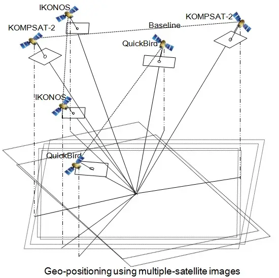
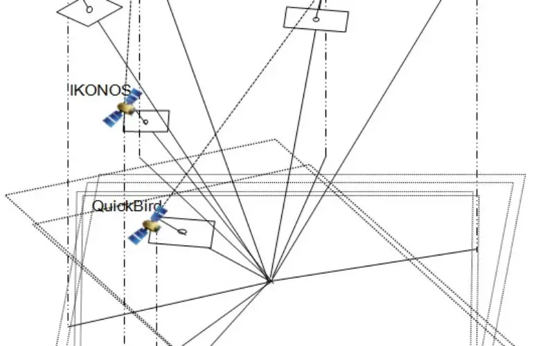
Abstract: This paper investigates the positioning accuracy of image pairs achieved by integrating images from multiple satellites. High-resolution satellite images from IKONOS, QuickBird, and KOMPSAT-2 for Daejeon, Korea were combined to produce pairs of stereo images. From single-satellite stereo pairs to multiple-satellite image pairs, all available combinations were analyzed via a rational function model (RFM). The positioning accuracy of multiple-satellite pairs was compared to a typical single-satellite stereo pair. The results show that dual-satellite integration can be an effective alternative to single-satellite stereo imagery for horizontal position mapping, but is less accurate for vertical mapping. The integration of additional higher-resolution images can improve the overall accuracy of the existing two images, but, conversely, may result in lower accuracy when very weak convergence or bisector elevation (BIE) angles occur. This highlights that the use of higher resolution images may not ensure improved accuracy, as it can result in very weak geometry. The findings confirm that multiple-satellite images can replace or enhance typical stereo pairs, but also suggest the need for careful verification, including consideration of various geometric elements and image resolution. This paper reveals the potential, limitations, and important considerations for mapping applications using images from multiple satellites.
Keywords: geo-positioning; multiple-satellite; image integration; IKONOS; QuickBird; KOMPSAT-2
Download Full Paper