
Today I was wondering while thinking what I should post on GIS Resources. Then suddenly I got a click, why not about Geo-referencing?
It’s seems to be a very easy term but for beginners some time quite confusing. Let’s have a look in deep.
Before I move to Geo-referencing, I would like to explain few Geo-spatial terminologies like Spatial Data, Co-ordinate System, Datum and Map Projection. As these terms have a significance meaning and importance while geo-referencing (how we will see down the line).
Spatial Data:
Positional information of features either on the surface of earth or on the map are called spatial data. Spatial data can be abstracted in to three main categories called points, lines and area.
- Point: Spatial data with no or zero dimension, no direction and no area.

- Line: Spatial data with one dimension, direction and no area.

- Area: Spatial data with two dimensions.
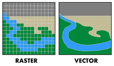
Digital spatial data can be represented in one of the two systems called Vector or Point system and Raster or Cell system.
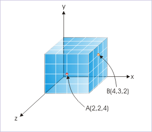
In vector system, points are represented by single pair of (x, y) Co-ordinate, lines by a series of (x, y) Co-ordinate pairs and areas by a series of (x, y) Co-ordinate pairs where first and last points are same.
In raster system, points are represented by single cells, lines by sequence of neighboring cells and area by collection of continuous cells.
Co-ordinate System:
It is a system by which Co-ordinate of any position on the surface of earth can be determined on itself or on a map or on a computer screen.
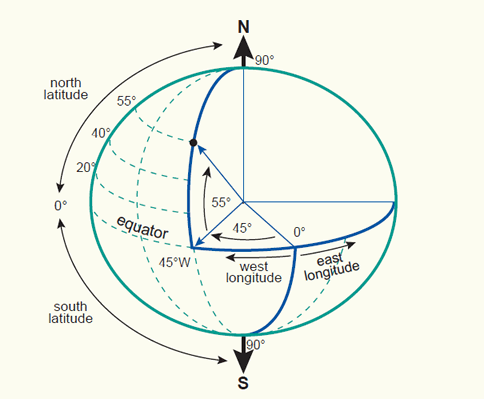
- Geographic Co-ordinate System or Spherical Co-ordinate System: Co-ordinate system on earth’s surface is called geographic Co-ordinate system. In this system, position on earth’s surface is measured in terms of latitude and longitude using angular unit of measurement.
2. Projected Co-ordinate System or Cartesian Co-ordinate System: Co-ordinate system on map or on a computer screen is called a projected co-ordinate system. It is the result of a projection from geographic co-ordinate using a projection method. In this system a position on earth’s surface is measured in the terms of x co-ordinate and y co-ordinate or easting and northing using linear unit of measurement from an assumed origin.
I will discuss more about the co-ordinate system in my next post.
Here is one important note:
Note: Co-ordinate of a point depends on its datum and projection. Co-ordinate of the same point differs when either its datum is changed or its projection is changed or parameters of projection are changed.
Datum:
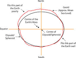
A datum is frame of reference for measuring locations on the surface of earth. So far different ellipsoids have been developed closely fitting to the surface of earth either or a part of it and they are called datum. When datum is closely fitting to the entire surface of earth, they are global datum and when they are closely fitting to a particular portion of the surface of earth they are called local datum.
For establishing vertical control we use vertical datum such as Mean Sea Level or Geoid or EGM 96.
Horizontal controls are established using horizontal datum such as WGS-84, GRS-80.
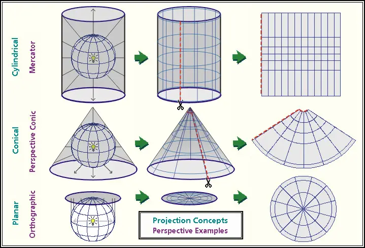
Map Projection:
Representation of earth’s curved surface on the flat surface either on a map or on a computer screen. For projection first datum is selected to model the surface of earth.
There are different projection methods best suiting to the area of map extent and preserving the map projection properties since curved surface of earth cannot be represented accurately on a flat surface.
Some of the common map projections are:
- Lambert Conformal Conic projection (LCC).
- Polyconic Projection
- Universal Traverse Mercator projection (UTM).
Now, I think understanding of Geo-referencing will be easier for all.
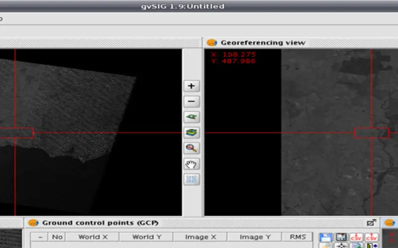
Geo-referencing:
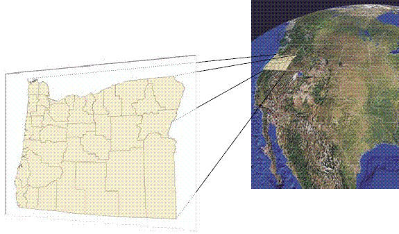
When co-ordinates of spatial dates are referenced to their corresponding positions on the surface of earth then it is called Geo-referencing of spatial data. Here data is registered with a co-ordinate system that is related to the earth’s surface that means a relationship is established between (x, y) co-ordinate on the map or on the computer screen and its corresponding latitude, longitude co-ordinate on earth’s surface.
In order to achieve this, first datum is selected to model the surface of earth. Then the latitude and longitude co-ordinates on the datum surface are projected on to a paper or on a computer screen which is called map projection.
After that spatial data of that area are referenced to the map projection by co-ordinate transformation.
Thus in Geo-referencing of spatial data, it requires the knowledge of co-ordinate system including datum, map projection and co-ordinate transformation.
Please share and like, if you find useful.
Thank you!


i would like to learn more of georeffering and other gis components iam a student doing environmental enginneering…please help