
Tag "raster"
Experience Super Easy Raster Data Processing with a Single Click
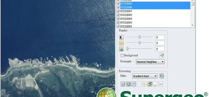
Supergeo has added the Image Analyzer on the upcoming SuperGIS Desktop 10, which will provide greater convenience for GIS users to process raster data. Image Analyzer can integrate raster data

Esri and NASA Collaborate to Advance Cloud Access to Imagery
Esri Opens LERC to the Geospatial Community Redlands, California—Esri and NASA are collaborating to improve access to imagery and raster data stored in the cloud using a combination of two

Webinar: Raster Processing In Global Mapper
Raster Processing In Global Mapper November 19, 2015 No Registration Required In many GIS processes and procedures, raster data serves as a static base map or reference layer upon which
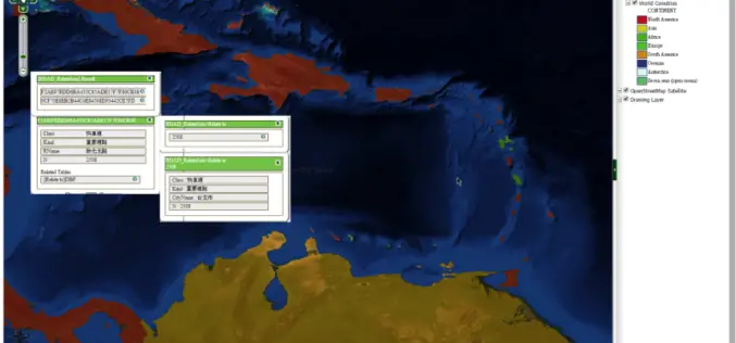
SuperGIS Server Extends Map Possibilities with Various Resources
This week, Supergeo releases the latest version of SuperGIS Server with plenty of new functions, including related tables, improved JavaScript print tool, and new JavaScript APIs supporting OGC layers. With
Insights to SuperGIS Server 10
Supergeo is going to upgrade all the products to a new level, the 10 series, including SuperGIS Server. The most exciting thing in SuperGIS Server 10 is its integration of
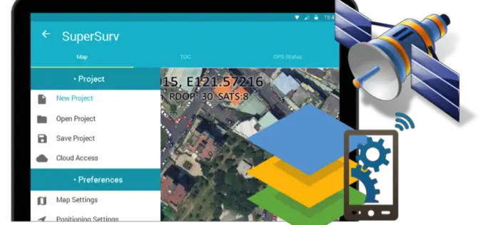
Behold! SuperSurv 10 Come for Unleashing the Power of Latest Technology in Mobile GIS
Can’t find the best fit mobile GIS solution for your field work? Wondering with all the hardcore and complicated operations in most survey Apps? Get ready to experience the brand
Discover Top 10 GIS Features with Latest SuperGIS Desktop
To make GIS software friendlier and easier to access, Supergeo, the leading GIS software provider, collects GIS users’ ideas around the world, and votes the 10 most useful features of
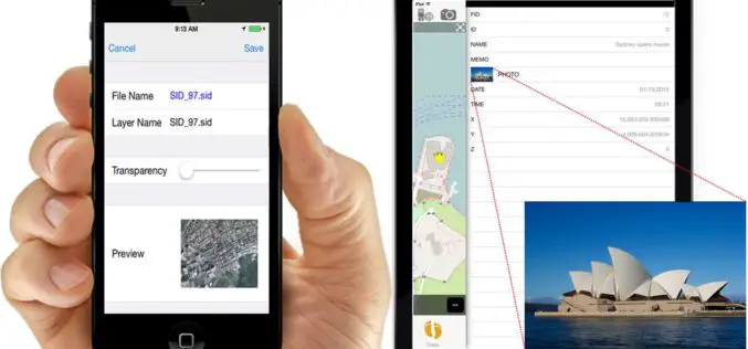
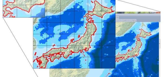
iOS Mapping Solution, SuperSurv, Enhances Raster Data Support
Supergeo releases the latest update of SuperSurv 3.2 (iOS) to enhance the functionality and efficiency for mobile GIS surveyors. Having stronger compatibility with raster dataset and convenient tools for data
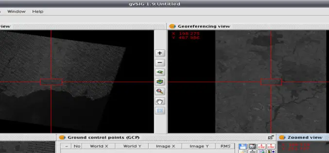
Geo-referencing ?
Today I was wondering while thinking what I should post on GIS Resources. Then suddenly I got a click, why not about Geo-referencing? It’s seems to be a very easy
