GeoAlert Unveils Latest AI Models for Building Footprints Customized to Specific Regions
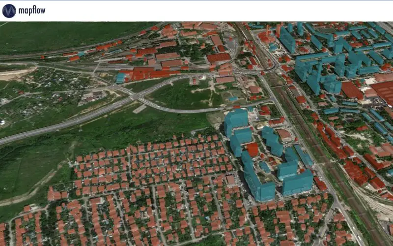
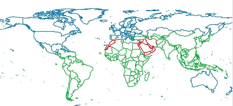
GeoAlert has released new AI models for Building footprints customized to region-specific and unified them under the single Buildings pipeline. Currently, there are 3 global regions and 3 corresponding Building segmentation models, which will be further improved.
Whatever neural network architecture is used, the output results depend on the quantity and quality of the training samples. Geoalert’s approach is to go for a ‘best-fit baseline model’ that can be quickly fine-tuned with additional training sets.
These fine-tuned models are integrated into the platform to be selected by the released recommendation algorithm with adjusted processing parameters based on the user input data. Launching the processing, the actual regional model is selected based on user area of interest and are now available at both Mapflow Web and Mapflow QGIS plugin.
Along with the new functionality the Mapflow QGIS plugin 1.8.0 was released. This new version includes updated user interface, enabled necessary features to work under team accounts, improvements in simplification and rate processing function. Around a year ago, the Geoalert implemented the feedback option into Mapflow.ai, allowing users to rate the processing results by simply scoring them from 1 to 5.
As the visual patterns and image conditions change substantially, this user feedback helps us to identify the problematic areas where the current models perform poorly as well as the areas where they can showcase the best of Mapflow performance. Geoalert’s public QGIS plugin for using Mapflow from inside QGIS is available at the GitHub.
Geoalert is an international startup that has developed an AI-powered SaaS platform called Mapflow.ai and promotes streaming services for Earth observation data. Currently Mapflow.ai can detect building footprints (with height), forest (with height), construction sites, roads, fields. Mapflow supports various imagery sources types including local GeoTIFF images, tile services on the Web, satellite free or commercial basemaps.
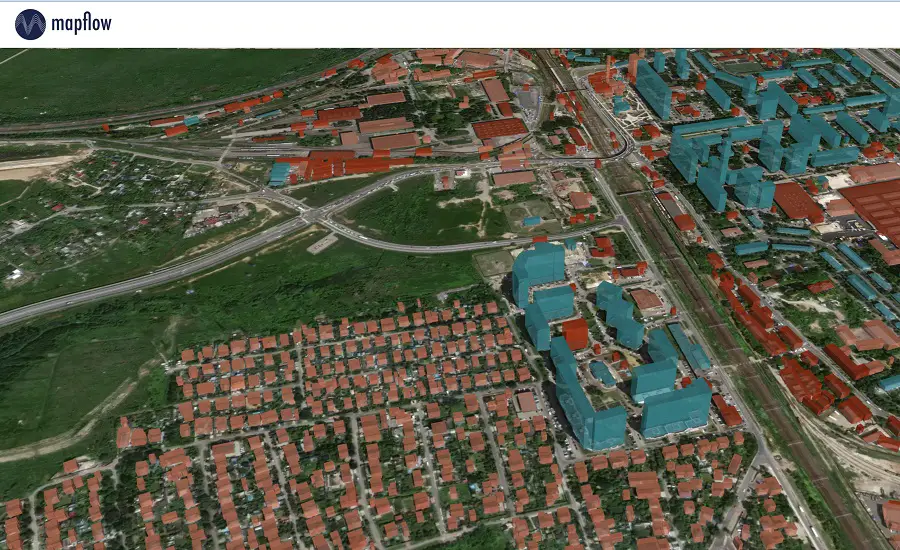
The core Mapflow machine learning models were trained with a ground sample distance (GSD) of 50 cm, and the new Aerial models are optimized for 10 cm resolution. This kind of image resolution makes it possible to train models to detect and map relatively small objects such as rooftop structures or single trees. That works for topo map creation (for scales from 1:500 to 1:25,000), radio frequency network design, classification of vegetation in rural and urban areas, and many other applications.
Also Read –
The Impact of Climate Change is Being Researched using AI by IBM and NASA