The All India Council of Technical Education (AICTE) has given approval on the inclusion of Geospatial subject GATE and NET examinations. The AICTE has taken the move on the recommendation of the National Geospatial Task Force Report 2013 under the Chairmanship of former ISRO Chairman, Dr. K. Kasturirangan.
Students appearing for lectureships and Junior Research Fellowships (JRF) in the Indian Universities, Colleges and organizations can choose the Graduate Aptitude Test in Engineering (GATE) and National Eligibility Test (NET).
This has come as a huge advantage to all the students in the domain of geospatial technology. Prior to this notification from the Ministry of Science and Technology, students have to choose other subjects (rather than geospatial subjects) to appear in the GATE and NET exam. This was a huge setback for geospatial students.
This will benefit the increasing number of students who are taking up geospatial as a subject at different levels and help in the evolution of the Geospatial Ecosystem in the country. The various opportunities of fellowship will also push the research and development activities in the geospatial domain.
Dr. K. C. Tiwari (Retd. Col), Department of Science and Technology’s Geospatial Chair Professor, Centre of Geoinformatics, Delhi Technological University, had made sincere efforts for the inclusion of Geospatial Subject in the GATE and NET examination, and the decision was an outcome of DST’s insistence and his hard work.
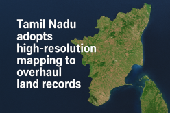
Geospatial science and technology is a rapidly evolving subject that forms the backbone of a plethora of planning, development, and governance activities with unprecedented opportunities both in the government and private sectors.
Swamitva, a recent scheme launched by the Hon’ble Prime Minister Modi is a good example to map rural inhabited lands using drones and the latest survey methods. The scheme among other things will streamline planning, revenue collection, and property rights and thus have a huge positive impact on securing loans by the owners and dispute resolution related to properties
Prof Ashutosh Sharma, Secretary, Department of Science and Technology
Additional Note –
SWAMITVA stands for Survey of Villages and Mapping with Improvised Technology in Village Areas. The Swamitva scheme is launched as a pilot mode in 6 states. Under the scheme, the latest surveying technology such as drones will be used for measuring the inhabited land in villages and rural areas.
The mapping and survey will be conducted in collaboration with the Survey of India, the State Revenue Department, and State Panchayati Raj Department under the Ministry of Panchayati Raj. The drones will draw the digital map of every property falling within the geographical limit of each Indian village. Property Cards will be prepared and given to the respective owners.
You may also like to read – A Career in GIS