Monitoring Active Volcanoes Using Aerial Images and the Orthoview Tool
Monitoring Active Volcanoes Using Aerial Images and the Orthoview Tool
– Maria Marsella, Carla Nardinocchi, Cristina Proietti, Leonardo Daga and Mauro Coltelli
 Abstract:
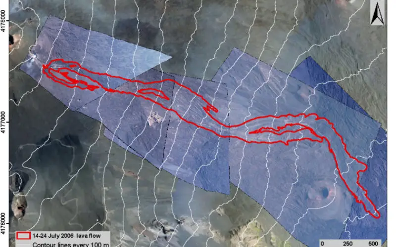
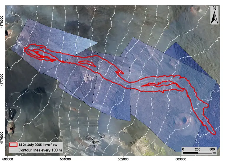
In volcanic areas, where it can be difficult to perform direct surveys, digital photogrammetry techniques are rarely adopted for routine volcano monitoring. Nevertheless, they have remarkable potentialities for observing active volcanic features (e.g., fissures, lava flows) and the connected deformation processes. The ability to obtain accurate quantitative data of definite accuracy in short time spans makes digital photogrammetry a suitable method for controlling the evolution of rapidly changing large-area volcanic phenomena. The systematic acquisition of airborne photogrammetric datasets can be adopted for implementing a more effective procedure aimed at long-term volcano monitoring and hazard assessment. In addition, during the volcanic crisis, the frequent acquisition of oblique digital images from helicopter allows for quasi-real-time monitoring to support mitigation actions by civil protection. These images are commonly used to update existing maps through a photo-interpretation approach that provide data of unknown accuracy. This work presents a scientific tool (Orthoview) that implements a straightforward photogrammetric approach to generate digital orthophotos from single-view oblique images provided that at least four Ground Control Points (GCP) and current Digital Elevation Models (DEM) are available. The influence of the view geometry, of sparse and not-signalized GCP and DEM inaccuracies is analyzed for evaluating the performance of the developed tool in comparison with other remote sensing techniques. Results obtained with datasets from Etna and Stromboli volcanoes demonstrate that 2D features measured on the produced orthophotos can reach sub-meter-level accuracy.
Keywords: digital photogrammetry, oblique images, orthophoto, orthoview, volcanic monitoring, rapid mapping
This is an open access article distributed under the Creative Commons Attribution License which permits unrestricted use, distribution, and reproduction in any medium, provided the original work is properly cited.