
Tag "3D mapping"
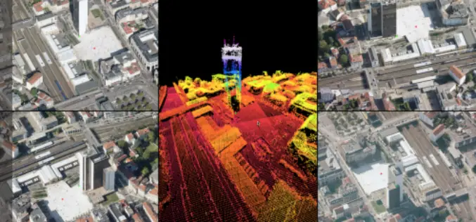
Orbit GT Releases 3D Mapping Feature Extraction Standard v18
Orbit GT launches the 3D Mapping Feature Extraction Standard product version 18. “We’re pleased to announce the release of our second product from the Feature Extraction portfolio”, says Peter Bonne,

3D Modeling to Plan Development Projects in Jaipur City
Jaipur, India – According to recent news reported by the TOI, the Department of Information Technology and Communications (DIoTC) of Jaipur, has undertaken an ambitious ‘3D City Model’ project. The
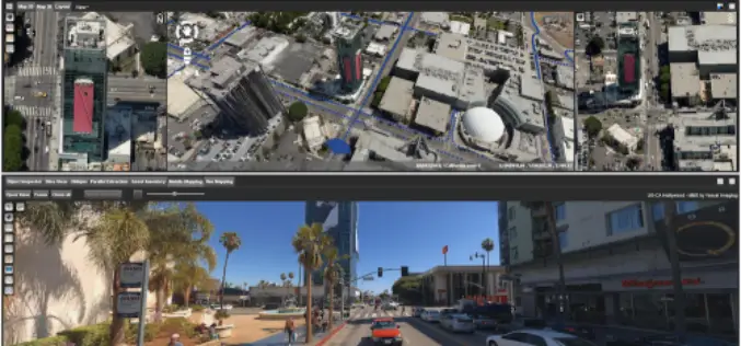
Orbit GT Updates 3D Mapping Cloud With Oblique Imagery Support
“After support for Mobile Mapping and UAS Mapping content, we now proudly announce the support for Oblique Imagery and Aerial Point Clouds. From now on, anyone owning Oblique data can
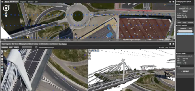
Orbit GT Releases UAS Mapping v17.1 With Cloud Upload Feature at UAV EXPO, Brussels
Orbit GT releases v17.1 of its UAS Mapping desktop product including the all-new Upload to the Cloud feature. It is available for download today from our website www.orbitgt.com. “This upgrade includes

3D Mapping to Investigate Traffic Accident Cases
Singapore – According to recent news by The Star Online, traffic police officers from the Fatal Accident Investigation Team (FAIT) of Singapore are recreating event of accident site using 3D

3D Mapping of Delhi Metro Station to Help CISF
New Delhi, India – According to recent news the DNA, all the major Delhi Metro stations have gone through the 3D mapping, this shall certainly help Central Industrial Security Force (CISF)
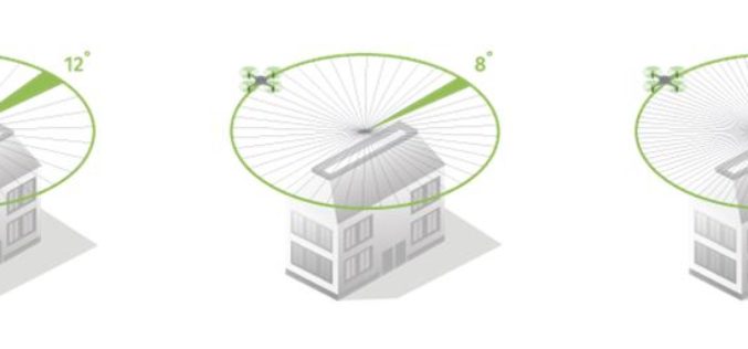
How Do I Choose the Right Image-capture Settings for 3D Models?
How do I choose the right image-capture settings for 3D models? What are the effects of the “angle between images” setting in circular missions when it comes to 3D reconstruction?

South Korea Government Using Drones to Map Hazardous Areas
According to recent news by Korea Bizwire – On Tuesday, the Ministry of Land, Infrastructure and Transport demonstrated its latest 3D-mapping technology that makes use of drones, at the Han River
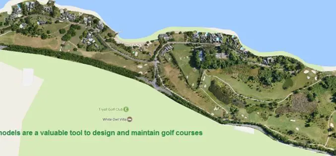
Three Reasons Golf Courses Are the Next Drone Mapping Territory
The emerald golfing greens have seen better days. According to the US National Golf Foundation, the number of players has almost steadily declined from over 30 million in 2005 (pre-recession),
Golden Software Releases Surfer 2D and 3D Mapping, Modeling, and Analysis Software
Latest Version Includes Contour Line and Grid Editing Features, User Interface Improvements, Image Georeferencing, Streamlined Workflows, and Access to Online Data. GOLDEN, COLORADO, February 14, 2017 – Golden Software, the
