According to recent news by Korea Bizwire – On Tuesday, the Ministry of Land, Infrastructure and Transport demonstrated its latest 3D-mapping technology that makes use of drones, at the Han River Drone Park.
According to officials, the system will allow for a better response to large-scale disasters such as nuclear power plant accidents or in military conflicts, by enabling authorities to acquire the affected areas’ spatial information more quickly and safely.
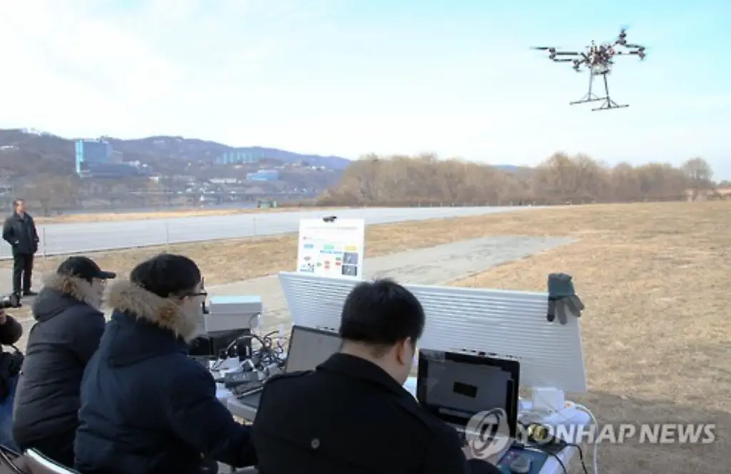
Image Source: Korea Bizwire
The drones, equipped with high-precision location sensors, send data to the “automatic mapping software,” which then provides a 3D map of the area.
The ministry will demonstrate its technology for UN authorities and UN Peacekeeping officials at the United National Logistics Base in Brindisi, Italy, in April.