
Tag "China"

China to Open Doors for Commercial Remote Sensing Satellite
BEIJING: A Chinese province, one of the communist nations oldest industrial bases, plans to launch its first indigenous remote sensing satellite for commercial use in October. Northeast China’s Jilin Province

China Launches Gaofen 8 Earth Observation Satellite
In recent news, China has successfully launched the Gaofen 8, a high resolution optical remote sensing satellite into a scheduled near-circular orbit with an average altitude of around 473 kilometers, or

Mount Everest Moved 3 cm, Height Not Affected By Nepal Earthquakes
Beijing: Mount Everest moved three cms during the recent devastating earthquakes in Nepal but contrary to earlier reports the height of world’s tallest mountain has not been affected, Chinese official monitoring
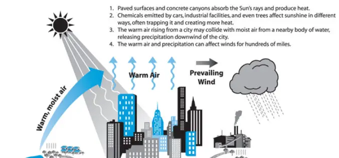
Analysis of the Urban Heat Island Effect in Shijiazhuang, China Using Satellite and Airborne Data
Analysis of the Urban Heat Island Effect in Shijiazhuang, China Using Satellite and Airborne Data – Kai Liu, Hongbo Su, Lifu Zhang, Hang Yang, Renhua Zhang and Xueke Li Abstract: The urban heat island (UHI)
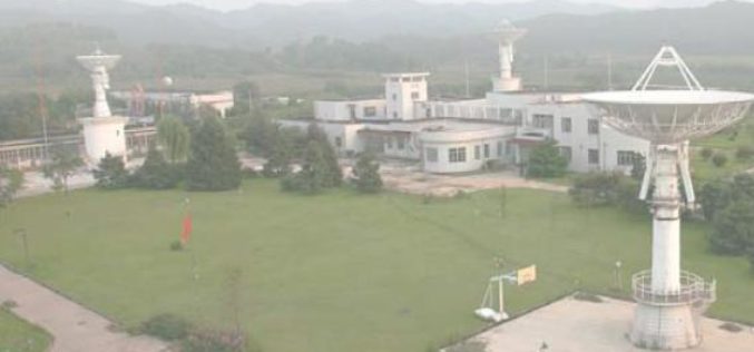
China to Setup Satellite Data Receiving Station in the Arctic
In a recent news by CRI English, China is working to setup its first overseas satellite data receiving station in the Arctic. The station, which is expected to start operation
China to Build Comprehensive EO System in 10yrs
Beijing: China plans to build an earth observation system that integrates use of air, space and ground based technology, including drones, satellites and GPS systems in the next ten years, a top

India Sings MoU with China on Peaceful Use of Space
September 20, 2014: In a visit to India, Chinese President Xi Jinping signed a series of documents with India at the Hyderabad House in New Delhi, strengthening ties between the
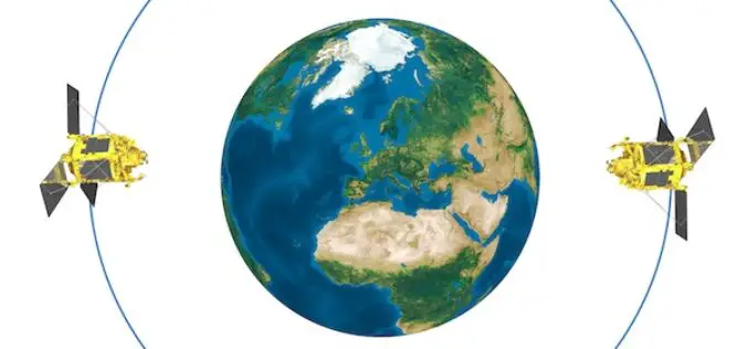
China Plans to Setup Constellation of Satellites to Monitor Entire World
In recent news, China is aggressively planning and considering the need of its network of surveillance and earth observation satellites to cover entire world. The move was reportedly inspired by
China Gathers Data of its 10, 500 Islands
In recent news, China has gathered detailed topographic topographic information and images of all its 10, 500 islands using remote sensing technology. It took three years of work by the aviation
