
Tag "China"

Saudi Arabia to Launch Remote Sensing Satellite from China
Riyadh — King Abdulaziz City for Science and Technology (KACST) is working to complete preparation of the components of the Saudi satellite (Saudi SAT 5B) which is locally made, in

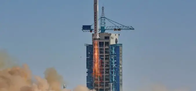
China Launches Gaofen-4 Remote Sensing
The Chinese have closed out the year with the launch of Gaofen-4 Remote Sensing from Long March 3B/G2 rocket. The launch involved the orbiting of a geostationary remote sensing bird,

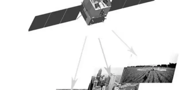
China Plans to Build Remote Sensing Satellite Network with Global Coverage
China is planning to build a remote sensing satellite network with global coverage by setting up more ground stations overseas. The move will enable China to provide diversified data to foreign
China Released New Regulations on Maps to Boost Geographic Information Industry
China has released new regulations on maps to boost development of the geographic information industry. The new regulations includes, a new chapter on online map services, as well as new

UK and China to Monitor Bridge Movement Using Satellite
The University of Nottingham (UK) has signed up a MoU with the huge construction conglomerate China Railway Group to develop and commercialise advanced satellite techniques to monitor the structural integrity
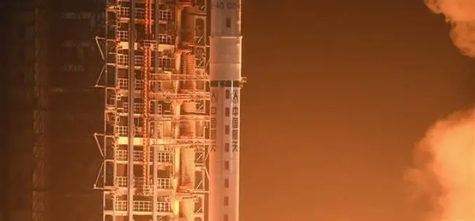
China Launches Yaogan-29 Remote Sensing Satellite
China has successfully launched a remote sensing satellite named was carried by a Long March – 4C rocket after it was launched on Thursday from Taiyuan in the country’s northern Shanxi
China’s Geoinformation Industry to Touch $6.6 Billion: Official
Beijing, Nov 10, 2015 – China’s geoinformation industry is booming with the output value expected to touch 360 billion yuan (USD 56.6 billion) this year, an increase of 22 per
China Launches Tianhui-1 Remote Sensing Satellite
Beijing: China has successfully sent its third mapping satellite of the Tianhui-1 series into orbit on Oct. 26, 2015. Tianhui-1 will enhance the country’s ability to carry out scientific research, mapping and disaster
China’s First High-Resolution Satellite Maps Large Part of World
BEIJING: The Ziyuan III, China’s first high-resolution stereo mapping satellite for civilian use, has sent back visual data covering 69.45 million square kilometres of the globe since it was launched in

China Launches its First Commercial Mission Jilin-1
China has entered into commercial market of remote sensing with the launch of the Jilin – 1 mission. China has recently launched Jilin-1 mission carrying four satellites on Oct. 7,
