
Tag "forest management"
Featured Article
LiDAR
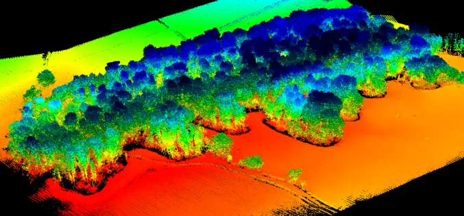
UAV LiDAR Technology in Forest Management
This case study from Routescene demonstrates the value of UAV LiDAR derived point cloud data for operational forest management.

Featured Article
Remote Sensing
Remote Sensing and GIS for Sustainable Forest Management
The data needed for forest management include wood procurement potential, forest cover, growing stock volume, and biomass carbon balance.

Webinars
A High-Accuracy Solution for Forest Management
SuperGIS Webinar: A High-Accuracy Solution for Forest Management Wednesday, 17th August 10:00 AM (GMT+2) Your local time Geospatial technology is changing how everything works, including industries with a long history such
GIS
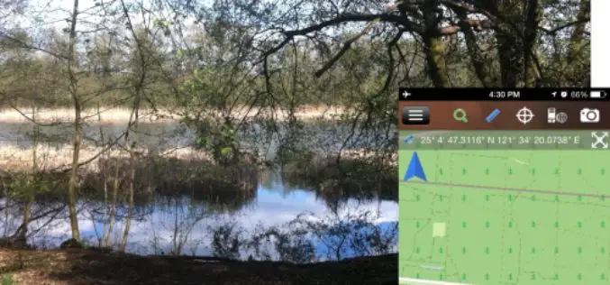
Brandenburg Forest Office, Germany, Select SuperSurv for Forest Conservation
Supergeo Technologies, the leading GIS software and solution provider, announces that Brandenburg Forest Office (Landesbetrieb Forest Brandenburg), Germany has adopted the smart mobile GIS app—SuperSurv to investigate the forest conservation
