
Tag "geospatial"

3rd International Conference on Geographical Information Systems Theory, Applications and Management – GISTAM 2017
The GISTAM Conference (The 3rd International Conference on Geographical Information Systems Theory, Applications and Management) organized by INSTICC (Institute for Systems and Technologies of Information, Control and Communication) will take

Govt May Review Provisions of Geospatial Bill: India
New Delhi, (PTI) Government may review some of the provisions of a draft bill that proposes jail term of seven years and a fine up to Rs 100 crore if

Kenya to Launch Aerial Survey of Minerals
According to recent news by the Standard Digital, Kenya will be launching an aerial survey to map out its minerals following a budgetary allocation of Sh 3 billion in the 2016-2017

Leica Geosystems Expands LiDAR Capabilities in ALS80 Airborne Sensor
(Heerbrugg,Switzerland/Anaheim, California, USA, 16 June 2016) – Leica Geosystems, global leader of measurement and reality capture technologies, today announced it has expanded functionality of the popular ALS80 airborne sensor that
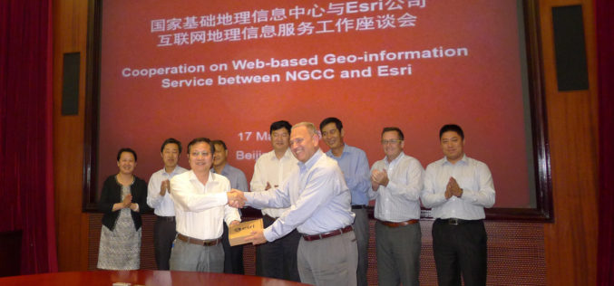
NGCC and Esri Provide Access to Authoritative Chinese Cartographic Maps and Imagery
Redlands, California—The world’s leading mapping platform company, Esri, and the National Geomatics Center of China (NGCC) held a signing ceremony in Beijing, China with respect to providing access to NGCC’s

UNITAR: Geospatial Technologies for Flood and Drought Management in East Africa
In the past decade, countries in East Africa have experienced several flood and drought related disasters. These events have led to severe economic and livelihood loss, which in turn greatly
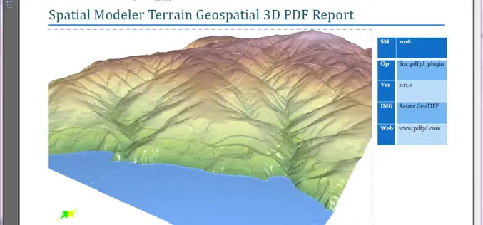
PDF3D Releases 3D Geospatial PDF Plugin for ERDAS IMAGINE at HxGN Live
PDF3D Plugin Released to Create High Quality Geospatial 3D PDF Documents from within ERDAS IMAGINE Spatial Modeler 2016. Anaheim California, June 13th, 2016 – Technological leaders, PDF3D, have today announced

Esri and Hexagon Promote Their Joint Collaboration at HxGN LIVE
Redlands, California—June 14, 2016—In 2015, Esri and Hexagon jointly announced a series of ready-to-use imagery services to Esri users through the ArcGIS Market Place. The ArcGIS Market Place delivers high-resolution

Hexagon kicks off HxGN LIVE conference in Anaheim, CA, USA
Hexagon, a leading global provider of information technologies that drive productivity and quality across geospatial and industrial enterprise applications, raises the curtain today on its annual HxGN LIVE event. Running
‘Geospatial Bill’ Step in Right Direction, But Needs Revamping: FICCI
FICCI said that govt should reconsider some aspects regarding mechanism for acquisition, storage, dissemination and distribution of data The Federation of Indian Chambers of Commerce and Industry (FICCI) appreciated the
