
Tag "GIS"

GIS to Provide Edge to Australia’s Military
A regional geospatial defence expert has urged the Australian Defence Force (ADF) to exploit the capabilities of Geographic Information System (GIS) technology to deliver greater operational and battlefield advantages to
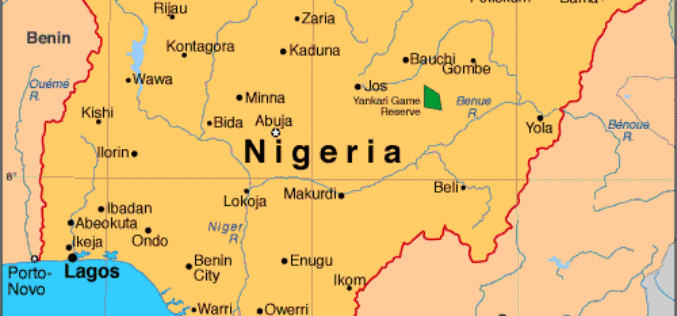
Government of Nigeria to Use Space Technology to Tackle Environmental Challenges
According to WorldStage Newsonline, The Federal Government of Nigeria is set to reposition space technology to tackle environmental challenges. Director of the National Centre for Remote Sensing (NCRS), Mr. Effron
Gartner Names GE a Leader in “Magic Quadrant” Report for Utilities Geographic Information Systems
Digital Energy business today announced that it has been named as one of the industry’s leading solutions provider of Utilities Geographic Information Systems software. This was announced in a recent

Environment Ministry Launches GIS Based Online Support Mechanism
Aimed at bringing transparency and reduce delays in regulatory clearances, the environment ministry today launched the Geographical Information System (GIS) based online support mechanism to help in taking
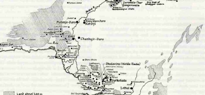
Geo-coordinates of 700 Harappan Sites in Gujarat to be updated in Maharaja Sayajirao University’s Gazette
An illustrated Gazetteer on 700 Harappan and affiliated Chalcolithic sites spread across Gujarat, which were surveyed using the GIS (Geographical Information System) to update the geo coordinates of these early

Andhra Pradesh to Initiate HARITA Initiative for Better Planning
Andhra Pradesh government plans to initiate another high-tech initiative called Harmonised Information of Agriculture, Revenue and Irrigation for a Transformation Agenda (HARITA). The initiative aims at creating an information highway in
NGA Announces CIA Veteran as Deputy Director
SPRINGFIELD, Virginia — The National Geospatial-Intelligence Agency announced today that Susan M. Gordon, a 34-year veteran of the intelligence community, will become deputy director upon the retirement of Mike Rodrigue,

Esri Advances Scientific Analysis with SciPy
ArcGIS Programming Library Adds Power to Problem-Solving Redlands, California—Esri announces the integration of SciPy and ArcGIS. Scientists, engineers, and GIS professionals will use SciPy to get more value from ArcGIS

QGIS 2.6 Brighton Has Been Relaesaed
The new version of QGIS 2.6 has been released. QGIS is a free and open source geograaphic information system (GIS). The new version has come up with many

Meet 1Spatial At Europe’s Largest Smart Energy Event
Come and meet 1Spatial at European Utility Week 2014 running from 4th–6th November at RAI, Amsterdam, Netherlands Cambridge, 30 October 2014. 1Spatial plc, global specialists in Spatial Big Data management,
